Polar Remote Sensing: Volume II: Ice Sheets: Springer Praxis Books
Autor Robert Massom, Dan Lubinen Limba Engleză Paperback – 16 noi 2014
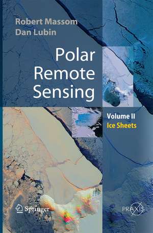
Volume 2 focuses on the ice sheets, icebergs, and interactions between ice sheets and the atmosphere and ocean. It contains information about the applications of satellite remote sensing in all relevant polar related disciplines, including glaciology, meteorology, climate and radiation balance and oceanogaraphy. It also provides a brief review of the state-of-the-art of each discipline, including current issues and questions. Various passive and active remote sensor types are discussed, and the book then concentrates on specific geophysical applications. Its interdisciplinary approach means that major advances and publications are highlighted.
Polar Remote Sensing: Ice Sheets
- summarizes fundamental principles of detectors, imaging and geophysical product retrieval
- includes a chapter on the important new field of satellite synthetic-aperture radar interferometry
- is a "one stop shop" for polar remote sensing information
- contains significant new information on the Earth's polar regions
- describes sophisticated groundbased remote sensing applications with specific reference to their use in polar regions.
| Toate formatele și edițiile | Preț | Express |
|---|---|---|
| Paperback (2) | 1598.13 lei 6-8 săpt. | |
| Springer Berlin, Heidelberg – 16 noi 2014 | 1598.13 lei 6-8 săpt. | |
| Springer Berlin, Heidelberg – 23 aug 2016 | 1606.65 lei 38-44 zile | |
| Hardback (2) | 1602.09 lei 6-8 săpt. | |
| Springer Berlin, Heidelberg – 13 dec 2005 | 1602.09 lei 6-8 săpt. | |
| Springer Berlin, Heidelberg – 2 noi 2005 | 1790.29 lei 6-8 săpt. |
Din seria Springer Praxis Books
-
 Preț: 289.23 lei
 -
 Preț: 279.98 lei
 -
 Preț: 211.74 lei
 - 18%
 Preț: 972.77 lei
 -
 Preț: 328.46 lei
 -
 Preț: 312.23 lei
 - 15%
 Preț: 400.41 lei
 -
 Preț: 214.26 lei
 -
 Preț: 311.83 lei
 -
 Preț: 331.05 lei
 -
 Preț: 208.76 lei
 - 18%
 Preț: 880.70 lei
 -
 Preț: 238.54 lei
 -
 Preț: 206.86 lei
 - 18%
 Preț: 972.87 lei
 -
 Preț: 202.14 lei
 -
 Preț: 253.85 lei
 -
 Preț: 258.06 lei
 -
 Preț: 199.87 lei
 -
 Preț: 354.47 lei
 -
 Preț: 228.63 lei
 -
 Preț: 283.58 lei
 -
 Preț: 158.86 lei
 - 18%
 Preț: 1214.51 lei
 - 18%
 Preț: 918.30 lei
 -
 Preț: 295.76 lei
 - 18%
 Preț: 1197.18 lei
 - 15%
 Preț: 626.98 lei
 - 15%
 Preț: 632.63 lei
 -
 Preț: 303.13 lei
 -
 Preț: 220.59 lei
 -
 Preț: 327.79 lei
 -
 Preț: 304.65 lei
 -
 Preț: 178.37 lei
 -
 Preț: 244.72 lei
 -
 Preț: 260.75 lei
 -
 Preț: 212.35 lei
 -
 Preț: 250.37 lei
 -
 Preț: 238.83 lei
 -
 Preț: 248.62 lei
 -
 Preț: 339.49 lei
 -
 Preț: 238.58 lei
 -
 Preț: 320.52 lei
 -
 Preț: 320.88 lei
 -
 Preț: 253.85 lei
 -
 Preț: 313.31 lei
 -
 Preț: 107.51 lei
 - 18%
 Preț: 1178.23 lei
 -
 Preț: 308.57 lei
 - 18%
 Preț: 1179.60 lei
Preț: 1598.13 lei
Preț vechi: 1948.95 lei
-18%
Puncte Express: 2397
Preț estimativ în valută:
282.65€ • 328.09$ • 245.99£
282.65€ • 328.09$ • 245.99£
Carte tipărită la comandă
Livrare economică 18 aprilie-02 mai
Specificații
ISBN-13: 9783642421266
ISBN-10: 3642421261
Pagini: 520
Ilustrații: XXXII, 426 p.
Dimensiuni: 155 x 235 x 27 mm
Greutate: 0.72 kg
Ediția:2006
Editura: Springer Berlin, Heidelberg
Colecția Springer
Seriile Springer Praxis Books, Geophysical Sciences
Locul publicării:Berlin, Heidelberg, Germany
ISBN-10: 3642421261
Pagini: 520
Ilustrații: XXXII, 426 p.
Dimensiuni: 155 x 235 x 27 mm
Greutate: 0.72 kg
Ediția:2006
Editura: Springer Berlin, Heidelberg
Colecția Springer
Seriile Springer Praxis Books, Geophysical Sciences
Locul publicării:Berlin, Heidelberg, Germany
V-ar putea interesa
-
 -29%Preț: 475.00 lei672.39 lei
 -
 -18%Preț: 1620.70 lei1976.47 lei
 -
 Preț: 247.47 lei
 -
 The Global Carbon CycleDavid ArcherPreț: 325.52 lei
 -
 Seismic InversionYanghua Wang-8%Preț: 554.21 lei602.41 lei
 -
 X-Ray Fluorescence Spectrometry (XRF) in GeoarchaeologyM. Steven ShackleyPreț: 403.10 lei
 -
 Environmental Impacts of Hydraulic FracturingFrank R. Spellman-9%Preț: 1200.28 lei1318.99 lei
 -
 Analytic Methods in GeomechanicsKam-tim Chau-15%Preț: 655.77 lei771.48 lei
 -
 -27%Preț: 75.76 lei103.55 lei
 -
 The PrincipiaIsaac NewtonPreț: 143.80 lei
 -
 Geoid Determination: Theory and MethodsFernando Sansò-18%Preț: 1782.54 lei2173.82 lei
Public țintă
ResearchCuprins
Polar ice sheets: Introduction.- Synthetic aperture radar interferometry and related techniques.- Satellite remote sensing of ice sheet parameters and processes.
Recenzii
From the reviews:
"Mapping the properties of Earth’s polar ice sheets may be remote sensing’s greatest success story. … The main source of confidence in this quest is the strength of polar remote sensing. This book provides an excellent reference and review and contains many of the best recent scientific illustrations and graphics from other publication. Any reader with a scientific interest in the Earth will be frankly astounded at the level of detail now accessible via satellite foe some of Earth’s most remote regions." (Ted A. Scambos, Journal of Geology, Vol. 116, 2008)
"Mapping the properties of Earth’s polar ice sheets may be remote sensing’s greatest success story. … The main source of confidence in this quest is the strength of polar remote sensing. This book provides an excellent reference and review and contains many of the best recent scientific illustrations and graphics from other publication. Any reader with a scientific interest in the Earth will be frankly astounded at the level of detail now accessible via satellite foe some of Earth’s most remote regions." (Ted A. Scambos, Journal of Geology, Vol. 116, 2008)
Textul de pe ultima copertă
Polar Remote Sensing is a two-volume work providing a comprehensive, multidisciplinary discussion of the applications of satellite sensing.
Volume 2 focuses on the ice sheets, icebergs, and interactions between ice sheets and the atmosphere and ocean. It contains information about the applications of satellite remote sensing in all relevant polar related disciplines, including glaciology, meteorology, climate and radiation balance and oceanogaraphy. It also provides a brief review of the state-of-the-art of each discipline, including current issues and questions. Various passive and active remote sensor types are discussed, and the book then concentrates on specific geophysical applications. Its interdisciplinary approach means that major advances and publications are highlighted.
Polar Remote Sensing: Ice Sheets
- summarizes fundamental principles of detectors, imaging and geophysical product retrieval
- includes a chapter on the important new field of satellite synthetic aperture radar interferometry
- is a "one stop shop" for polar remote sensing information
- contains significant new information on the Earth's polar regions
- describes sophisticated groundbased remote sensing applications with specific reference to their use in polar regions.
Caracteristici
Presentation of the topic in a multi-disciplinary way Information ranging from first principles to operational applications