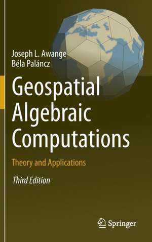
Geospatial Algebraic Computations
Autor Joseph Awange, Béla Palánczen Limba Engleză Hardback – 8 feb 2016
Preț: 684.28 lei
Preț vechi: 805.04 lei
-15%
Puncte Express: 1026
Carte tipărită la comandă
Livrare economică 07-21 decembrie
Livrare prin curier în România Termenul estimat este afișat lângă disponibilitate.
Transport gratuit pentru acest produs Plată online sau ramburs, în funcție de opțiunile comenzii.
Retur gratuit în 14 zile Comandă securizată și suport în română.
Specificații
ISBN-13: 9783319254630
ISBN-10: 3319254634
Pagini: 564
Ilustrații: XX, 541 p. 185 illus., 37 illus. in color.
Dimensiuni: 160 x 241 x 36 mm
Greutate: 0.95 kg
Ediția:3rd edition 2016
Editura: Springer
Locul publicării:Cham, Switzerland
ISBN-10: 3319254634
Pagini: 564
Ilustrații: XX, 541 p. 185 illus., 37 illus. in color.
Dimensiuni: 160 x 241 x 36 mm
Greutate: 0.95 kg
Ediția:3rd edition 2016
Editura: Springer
Locul publicării:Cham, Switzerland
V-ar putea interesa
-
 The Physics of GlaciersKurt M. Cuffey-29%Preț: 531.23 lei747.49 lei
-
 -26%Preț: 539.58 lei728.45 lei
-
 Seismic InterferometrySchuster Gerard ThomasPreț: 444.40 lei
-
 Introduction to SeismologyPeter M. Shearer-11%Preț: 559.43 lei628.57 lei
-
 An Introduction to Our Dynamic PlanetNick Rogers-19%Preț: 471.28 lei581.83 lei
-
 -23%Preț: 697.54 lei905.89 lei
-
 Earthquake and Volcano DeformationPaul Segall-19%Preț: 717.46 lei885.76 lei
-
 Seismic InversionYanghua Wang-8%Preț: 599.32 lei651.44 lei
-
 -25%Preț: 81.07 lei108.74 lei
-
 The PrincipiaIsaac NewtonPreț: 153.10 lei
-
 Geoid DeterminationFernando Sansò-18%Preț: 1912.89 lei2332.79 lei
Public țintă
ResearchCuprins
Part I Algebraic symbolic and numeric methods.- Basics of Ring Theory.- Basics of Polynominal Theory.- Groebner Basis.- Polynominal Resultants.- Linear and Nonlinear Homotpy.- Solutions of Overdetermined Systems.- Extended Newton-Raphson method.- Procrustes Solution.- EIV models and Pareto Optimality.-Symbolic Regression.- Robust Estimation.- Part II Applications to geodesy and geoinformatics.- LPS-GNSS Orientations and vertical Deflections.- Cartesian to Ellipsoidal Mapping.- Positioning by Ranging.-Positioning by resection Methods.- Positioning by intersection Methods.- GNSS Environmental Monitoring.- Algebraic Diagnosis of Outliers.- Datum Transformation Problems.- Appendix.- References.- Index.
Notă biografică
Professor Joseph Awange joined Spatial Sciences (School of Earth and Planetary Sciences, Curtin University, Australia) in 2006 under a Curtin Research Fellowship and concurrently undertook the prestigious Alexander von Humboldt (AvH) Fellowship at the Geodetic Institute (Karlsruhe Institute of Technology, Germany) having been awarded the Australian 2008-2011 Ludwig Leichhardt Memorial Fellowship for experienced researchers. In 2015, he won all the three major Fellowship Awards: Alexander von Humboldt (Germany), Japan Society of Promotion of Science (Japan), and Brazil Frontier of Science (Brazil) to carry out research in those countries. At Curtin University, he is currently Professor of Environmental Geoinformatics engaged in teaching and research having attracted more than $2.5M worth of research grants. He obtained his B.Sc. and M.Sc. degrees in Surveying from the University of Nairobi (Kenya) and was also awarded a merit scholarship by the German Academic Exchange Program (DAAD), which facilitated him obtaining a second M.Sc. degree and Ph.D. in Geodesy at Stuttgart University (Germany). In 2002-2004, he was awarded the prestigious Japan Society for Promotion of Science (JSPS) Fellowship to pursue postdoctoral research at Kyoto University (Japan). He attained International Editorial Role in Springer Earth Science Books and has authored more than 20 scholarly books with the prestigious Springer International Publishers and more than 200 peer-reviewed high-impact journal publications (e.g., Remote Sensing of Environment, Journal of Climate, Climatic Change, Advances in Water Resources, International Journal of Climatology, and Journal of Hydrology among others). His main research areas that have attracted media coverage (e.g., Environmental Monitor) are in the fields of (i) environmental geoinformatics: satellite environmental sensing (e.g., changes in global and regional stored water (surface, underground, ice, and soil moisture) using GRACE/GRACE-FO and TRMM satellites; climate change using GNSS and altimetry satellites), which is employed to face the emerging challenges of the twenty-first century posed by increased extreme hydroclimatic conditions, e.g., severity and frequency of droughts in Australia and Greater Horn of Africa (GHA), and the changing monsoon characteristics in Asia and Africa leading to floods, and (ii) mathematical geosciences: hybrid-symbolic solutions that delivers hybrid symbolic-numeric computations (HSNC), which is a large and growing area at the boundary of mathematics and computer science and currently an active area of research.
Textul de pe ultima copertă
Improved geospatial instrumentation and technology such as in laser scanning has now resulted in millions of data being collected, e.g., point clouds. It is in realization that such huge amount of data requires efficient and robust mathematical solutions that this third edition of the book extends the second edition by introducing three new chapters: Robust parameter estimation, Multiobjective optimization and Symbolic regression. Furthermore, the linear homotopy chapter is expanded to include nonlinear homotopy. These disciplines are discussed first in the theoretical part of the book before illustrating their geospatial applications in the applications chapters where numerous numerical examples are presented. The renewed electronic supplement contains these new theoretical and practical topics, with the corresponding Mathematica statements and functions supporting their computations introduced and applied. This third edition is renamed in light of these technological advancements.
Caracteristici
All important algorithms algebraic symbolic (resultants, Gröbner basis) and algebraic numeric (homotopy, Procrustes) are under one roof The book provides theoretical as well as practical applications of the algorithms All of these methods are discussed from a geospatialist point of view and applied accordingly The book provides the only available electronic supplement with CAS, which ensures the computations all of these subjects with one software (Mathematica) No special mathematical background is required to understand the theories and their applications