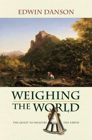
Weighing the World: The Quest to Measure the Earth
Autor Edwin Dansonen Limba Engleză Hardback – 26 ian 2006
Preț: 506.29 lei
Preț vechi: 568.86 lei
-11%
Puncte Express: 759
Carte tipărită la comandă
Livrare economică 20-26 august
Livrare prin curier în România Termenul estimat este afișat lângă disponibilitate.
Transport gratuit pentru acest produs Plată online sau ramburs, în funcție de opțiunile comenzii.
Retur gratuit în 14 zile Comandă securizată și suport în română.
Specificații
ISBN-13: 9780195181692
ISBN-10: 0195181697
Pagini: 304
Ilustrații: 15 halftones, 45 line drawings
Dimensiuni: 166 x 236 x 19 mm
Greutate: 0.56 kg
Editura: Oxford University Press
Colecția OUP USA
Locul publicării:New York, United States
ISBN-10: 0195181697
Pagini: 304
Ilustrații: 15 halftones, 45 line drawings
Dimensiuni: 166 x 236 x 19 mm
Greutate: 0.56 kg
Editura: Oxford University Press
Colecția OUP USA
Locul publicării:New York, United States
V-ar putea interesa
-
 The Natural History of the Long Expedition to the Rocky Mountains (1819-1820)Howard Ensign EvansPreț: 150.23 lei
 -
 Drawing the LineEdwin DansonPreț: 210.10 lei
 -
 Lake Paradise Fun BookJobe David LeonardPreț: 68.40 lei
 -
 Lake Parker Fun BookJobe David LeonardPreț: 68.40 lei
 -
 Lake Paul Fun BookJobe David LeonardPreț: 68.40 lei
 -
 Lake Peigneur Fun BookJobe David LeonardPreț: 68.40 lei
 -
 Lake Pend Oreille Fun BookJobe David LeonardPreț: 68.40 lei
 -
 Lake Piedmont Fun BookJobe David LeonardPreț: 68.40 lei
 -
 Lake Pillsbury Fun BookJobe David LeonardPreț: 68.40 lei
 -
 Lake Pippen Fun BookJobe David LeonardPreț: 68.40 lei
 -
 Lake Pocotopaug Fun BookJobe David LeonardPreț: 68.40 lei
 -
 Lake Poinsett Fun BookJobe David LeonardPreț: 68.40 lei
 -
 Lake Pontchartrain Fun BookJobe David LeonardPreț: 68.40 lei
 -
 Lake Powell Fun BookJobe David LeonardPreț: 68.40 lei
 -
 Lake Quannapowitt Fun BookJobe David LeonardPreț: 68.40 lei
 -
 Lake Quinault Fun BookJobe David LeonardPreț: 68.40 lei
 -
 Lake Rabon Fun BookJobe David LeonardPreț: 68.40 lei
 -
 Lake Rabun Fun BookJobe David LeonardPreț: 68.40 lei
 -
 Lake Ray Roberts Fun BookJobe David LeonardPreț: 68.40 lei
 -
 Lake Red Rock Fun BookJobe David LeonardPreț: 68.40 lei
 -
 Lake Redfield Fun BookJobe David LeonardPreț: 68.40 lei
 -
 Lake Rico Fun BookJobe David LeonardPreț: 68.40 lei
 -
 Lake Robinson Fun BookJobe David LeonardPreț: 68.40 lei
 -
 Lake Rousseau Fun BookJobe David LeonardPreț: 68.40 lei
 -
 Lake Russell Fun BookJobe David LeonardPreț: 68.40 lei
 -
 Lake Sabbatia Fun BookJobe David LeonardPreț: 68.40 lei
 -
 Lake Sakakawea Fun BookJobe David LeonardPreț: 68.40 lei
 -
 Lake Saltonstall Fun BookJobe David LeonardPreț: 68.40 lei
Recenzii
Danson has an excellent feel for the practicalities of surveying ... he also has the makings of a good story.
It makes highly interesting reading for high school and college level students and a fine reference for individuals wishing to learn more about this important facet of science history - our civilization's attempt to measure accurately the longitude and latitude as a basis for accurate maps and to provide accurate specific locations for all types of research on Earth. Environmental Geology, (2006) 50: 1105-1106
MEASURING the shape of the world in the 18th century was a considerable adventure. Astronomers had to haul equipment to remote corners of the globe to look for its subtle deviations from a perfect sphere. This is history writ large, with a long list of characters, and a background of wars, where good maps could be the key to victory. Danson's narrative sometimes wanders, but his asides can be priceless, like his description of the first British balloonists to cross the English Channel. To keep aloft they had to discard first ballast, then supplies, and ultimately most of their clothing. New Scientist USA Print Edition. January 2006.
Notă biografică
Edwin Danson is a member of the Royal Institution of Chartered Surveyors and a Fellow of the Institution of Civil Engineering Surveyors. He is the author of Drawing the Line: How Mason and Dixon Surveyed the Most Famous Border in America.