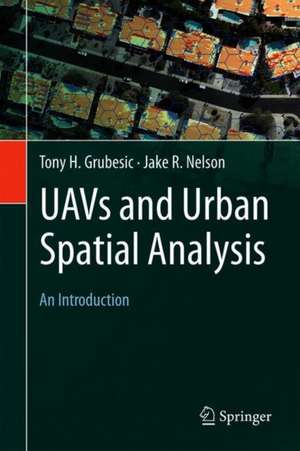
UAVs and Urban Spatial Analysis
Autor Tony H. Grubesic, Jake R. Nelsonen Limba Engleză Hardback – 11 ian 2020
This book provides an introduction to the use of unmanned aerial vehicles (UAVs) for the geographic observation and spatial analysis of urban areas. The velocity of urban change necessitates observation platforms that not only enhance situational awareness for planning and allied analytical efforts, but also provide the ability to rapidly and inexpensively collect data and monitor change. UAVs can accomplish both of these tasks, but their use in urban environments is loaded with social, operational, regulatory and technical challenges that must be addressed for successful deployments.
The book provides a resource for educators and students who work with geographic information and are seeking to enhance these data with the use of unmanned aerial vehicles. Topics covered include, 1) a primer on UAVs and the many different ways they can be used for geographic observation, 2) a detailed overview on the use of aviation maps and charts for operating UAVs in complex urban airspace, 3) techniques for integrating UAV-derived data with more traditional geographic information, 4) application of spatial analytical tools for urban and environmental planning, and 5) an exploration of privacy and public safety issues associated with UAV operation.
Preț: 1068.25 lei
Preț vechi: 1405.59 lei
-24%
Puncte Express: 1602
Carte tipărită la comandă
Livrare economică 30 noiembrie-05 decembrie
Livrare prin curier în România Termenul estimat este afișat lângă disponibilitate.
Transport gratuit pentru acest produs Plată online sau ramburs, în funcție de opțiunile comenzii.
Retur gratuit în 14 zile Comandă securizată și suport în română.
Specificații
ISBN-13: 9783030358648
ISBN-10: 303035864X
Pagini: 220
Ilustrații: XIV, 206 p. 68 illus., 66 illus. in color.
Dimensiuni: 160 x 241 x 17 mm
Greutate: 0.49 kg
Ediția:1st ed. 2020
Editura: Springer
Locul publicării:Cham, Switzerland
ISBN-10: 303035864X
Pagini: 220
Ilustrații: XIV, 206 p. 68 illus., 66 illus. in color.
Dimensiuni: 160 x 241 x 17 mm
Greutate: 0.49 kg
Ediția:1st ed. 2020
Editura: Springer
Locul publicării:Cham, Switzerland
Cuprins
Chapter 1-Introduction to UAVs and urban spatial analysis.- Chapter 2-UAV platforms and implications for geographic observation.- Chapter 3-A primer on aeronautical charts and maps.- Chapter 4-Legal, environmental, operational and safety challenges in urban areas.- Chapter 5-UAVs and privacy.- Chapter 6-UAV data integration with geographic information systems.- Chapter 7-Application 1: remotely sensing physical disorder.- Chapter 8-Application 2: urban vegetation management.- Chapter 9-Application 3: disasters, pest control and emerging diseases.- Chapter 10-Application 4: water management for urban recreational areas.- Chapter 11-Application 5: structure from motion photogrammetry.- Chapter 12-UAVs and urban futures.
Notă biografică
Wade Bishop is an assistant professor in the School of Information Sciences at the University of Tennessee, Knoxville. Bishop has an M.L.I.S. from the University of South Florida and a Ph.D. from Florida State University. His research focus is on geographic information (GI) organization, access and use, as well as the study of GI occupations, education, and training. He has other research expertise that includes physical access for users to U.S. public libraries (using Geographic information Systems (GIS)) and the evaluation of many other services and resources in academic and public libraries. He has professional experience as an assistant professor, teacher, academic librarian, graduate research associate, teaching assistant, and instructor. In 2011, he received an IMLS grant titled Geographic Information Librarianship (GIL), with Tony Grubesic, to create and deliver coursework to prepare students with the knowledge, skills, and abilities to locate, retrieve, analyze, and make geospatial data accessible.
Tony H. Grubesic is Professor of Policy Analytics at Arizona State University, where he is also Director of the Center for Spatial Reasoning & Policy Analytics. He has previously held academic appointments at Drexel University, Oregon State University, Indiana University and the University of Cincinnati. His research and teaching interests are in geographic information science, regional development and public policy evaluation. Author of over 120 research publications, his recent work focuses on spatial analytics and data uncertainty, neighborhood dynamics, telecommunications policy and air transportation systems. Grubesic obtained a B.A. in Political Science from Willamette University, a B.S. in Geography from the University of Wisconsin-Whitewater, a M.A. in Geography from the University of Akron, and a Ph.D. in Geographic Information Science from Ohio State University.
Textul de pe ultima copertă
This book provides an introduction to the use of unmanned aerial vehicles (UAVs) for the geographic observation and spatial analysis of urban areas. The velocity of urban change necessitates observation platforms that not only enhance situational awareness for planning and allied analytical efforts, but also provide the ability to rapidly and inexpensively collect data and monitor change. UAVs can accomplish both of these tasks, but their use in urban environments is loaded with social, operational, regulatory and technical challenges that must be addressed for successful deployments.
The book provides a resource for educators and students who work with geographic information and are seeking to enhance these data with the use of unmanned aerial vehicles. Topics covered include, 1) a primer on UAVs and the many different ways they can be used for geographic observation, 2) a detailed overview on the use of aviation maps and charts for operating UAVs in complex urban airspace, 3) techniques for integrating UAV-derived data with more traditional geographic information, 4) application of spatial analytical tools for urban and environmental planning, and 5) an exploration of privacy and public safety issues associated with UAV operation.
Caracteristici
Provides an introduction to the use of unmanned aerial vehicles (UAVs) for the geographic observation of urban areas Offers resources for educators and students who work with geographic information and are seeking to enhance these data with the use of UAVs Addresses the applications of UAVs in urban and environmental planning, disaster response, and pest management