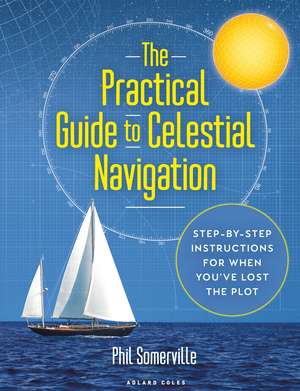
The Practical Guide to Celestial Navigation: Step-by-step instructions for when you've lost the plot
Autor Phil Somervilleen Limba Engleză Hardback – 14 oct 2021
Găsim în The Practical Guide to Celestial Navigation o abordare riguros structurată, concepută special pentru a transforma o disciplină adesea intimidantă într-un set de proceduri logice și aplicabile. Phil Somerville pornește de la concepte fundamentale, precum rotația terestră și cercurile mari, avansând metodic spre definirea poziției geografice prin declinație și unghiul orar Greenwich (GHA). Această progresie asigură faptul că cititorul nu doar execută niște calcule, ci înțelege mecanica cerească din spatele fiecărei măsurători.
Spre deosebire de alte manuale tehnice care pot copleși prin formalism matematic, această lucrare publicată de Adlard Coles pune accent pe execuția pe punte. Ca și Alexander Arnfinn Olsen în Introduction to Celestial Navigation, autorul distilează experiență reală în principii acționabile, subliniind rolul critic al sextantului ca metodă de rezervă atunci când tehnologia digitală eșuează. Elementul distinctiv al cărții lui Somerville este componenta practică post-învățare: includerea unor fișe tip 'proforma' și a unui capitol dedicat depanării erorilor frecvente. Aceste instrumente sunt esențiale pentru a evita blocajele în momentele de stres, oferind o structură clară pentru corecțiile de sextant (eroarea de indice, depresiunea orizontului) și utilizarea tabelelor de reducție (Sight Reduction Tables).
Fiecare etapă este susținută vizual de diagrame color și ilustrații care clarifică triunghiul PZX și metoda Intercept. Cartea reușește să pună în context informația teoretică, făcând-o memorabilă pentru marinarii care se pregătesc pentru certificări comerciale sau pentru examenul RYA Ocean Yachtmaster, fără a presupune cunoștințe prealabile vaste.
Preț: 205.11 lei
Preț vechi: 338.85 lei
-39%
Carte disponibilă
Livrare economică 27 noiembrie-11 decembrie
Livrare express 13-19 noiembrie pentru 193.02 lei
Specificații
ISBN-10: 1472987586
Pagini: 160
Ilustrații: Full colour diagrams and illustrations throughout
Dimensiuni: 220 x 284 x 20 mm
Greutate: 0.88 kg
Editura: Bloomsbury Publishing
Colecția Adlard Coles
Locul publicării:London, United Kingdom
V-ar putea interesa
-
 Ultimate Navigation ManualLyle BrothertonPreț: 148.16 lei
-
 Emergency Navigation, 2nd EditionDavid Burch-10%Preț: 123.78 lei138.03 lei
-
 Celestial NavigationTom CunliffePreț: 85.93 lei
-
 -40%Preț: 68.01 lei114.13 lei
-
 Long Term Almanac 2000-2050Geoffrey KolbePreț: 158.95 lei
-
 Celestial Navigation in the GPS AgeJohn KarlPreț: 153.32 lei
-
 A Seaman's Guide to Basic ChartworkMalcolm SkenePreț: 113.75 lei
-
 Yachtmaster for Sail and Power 6th EditionRoger Seymour-19%Preț: 197.57 lei242.99 lei
-
 Pass Your Day SkipperDavid Fairhall-15%Preț: 112.31 lei132.27 lei
-
 Reeds Astro Navigation Tables 2024Kendall Carter-40%Preț: 168.84 lei281.61 lei
-
 Yachtmaster Exercises for Sail and Power 5th editionAlison Noice-20%Preț: 188.07 lei235.71 lei
-
 Reeds Astro Navigation Tables 2025Kendall Carter-41%Preț: 163.73 lei278.62 lei
-
 The Complete Yachtmaster 11th EditionTom Cunliffe-15%Preț: 246.35 lei290.46 lei
-
 Reeds Nautical Almanac 2026Perrin Towler-36%Preț: 349.43 lei541.91 lei
-
 Reeds Astro Navigation Tables 2026Kendall Carter-20%Preț: 241.48 lei302.53 lei
-
 Reeds Astro Navigation Tables 2027Kendall Carter-41%Preț: 179.36 lei305.52 lei
-
 Celestial Navigation for Yachtsmen: 13th editionMary Blewitt-41%Preț: 62.12 lei104.94 lei
-
 Practical Celestial NavigationSusan P. HowellPreț: 229.53 lei
-
 Navigation CompanionTim DavisonPreț: 63.24 lei
-
 Introduction to Celestial NavigationAlexander Arnfinn Olsen-19%Preț: 644.31 lei795.45 lei
De ce să citești această carte
Această carte este indispensabilă navigatorilor care doresc să stăpânească sextantul pentru siguranță sau certificări profesionale (RYA/MCA). Autorul elimină jargonul inutil și oferă fișe de calcul gata de utilizat pe punte. Veți câștiga încrederea de a vă determina poziția cu o precizie de 3-4 mile marine, folosind doar aștrii, un ceas și tabelele de calcul, transformând o teorie abstractă într-o competență practică vitală.
Descriere
Did you know that a person standing on the equator is effectively travelling at 900mph? And did you know that you can use this information to work out where you are in the world, to an accuracy of about 3 or 4 miles? No GPS, no computers. Just a sextant, some tables from an Almanac and the knowledge in this book.
It's the only back up if the GPS goes down, so it's a matter of safety. If you want to qualify as a commercial skipper/superyacht captain you need to know how to carry out celestial navigation. And if you want to pass the RYA Ocean YachtmasterT exam, you need to know it too. It's a major stumbling block for many sailors wanting or needing to take their next qualifications, and the other books on the market are complex and often assume some prior understanding. This book fulfils the need for a clear explanation of celestial navigation, illustrated with colour diagrams and including unique checklist sheets to enable you to repeat all those calculations you learned back at home, when you're on deck.
Without overwhelming the reader with a load of theory from the off, the author breaks down what you need to do, step by step, explaining why at every point - giving the information context, and making it more interesting and memorable. He has trained students in this subject for years, and here he's able to use his experiences of what works, and what are the common pitfalls - he even includes a troubleshooting chapter near the end, going through errors commonly made, and how to spot them. The objective is that readers will finish the book not only knowing what to do, but really understanding why, and being able to make sense of it all again later (rather than just getting through and exam and finding themselves at a loss when on deck). The author also includes time-tested 'proformas' - quick reference sheets that sailors can refer to when they come to putting the theory into practice on board, avoiding the terrifying 'cold start' that most sailors experience when they suddenly need to put their theoretical knowledge to the test in the real world.
Cuprins
Acknowledgements
Introduction
A bit of history
Why bother?
A bit about this book
Chapter 1 The basics
Latitude and longitude
Earth rotation
Great circles
Chapter 2 Foundation of celestial navigation and the geographical position
Geographical position (GP)
Position lines and lines of position
Chapter 3 Defining the geographical position
Declination
Greenwich Hour Angle (GHA)
Obtaining the sun's GP
Proforma introduction
Chapter 4 Sextant corrections
Index error
Height of eye (dip)
Altitude correction
Applying the corrections: example
Chapter 5 The PZX triangle
A bit of background
Chapter 6 The intercept method
Chapter 7 Sight Reduction Tables
The four keys
Chapter 8 Undertaking a full sight reduction
Resources
Sight reduction
Chapter 9 Sun sight reduction - Quick Start and recap
Resources
Completing a sun sight reduction
Chapter 10 Meridian passage
How we take the sight
Worked example
Resources
Chapter 11 Meridian passage - Quick Start and recap
Resources
Completing a meridian passage sight
Chapter 12 Plotting
Sun Run Sun: morning sun sight and meridian passage
Plotting a Sun Run Sun
Sun Run Sun: morning sight and afternoon sight
Sun Run Sun: meridian passage and afternoon sight
Chapter 13 Compass checking
Variation
Deviation
Sight reduction for compass checking
Checking for deviation
Worked example
Chapter 14 Time
Time zones
Chronometer
A practical solution for accurate timekeeping
International Date Line
Chapter 15 Sextant: Practical aspects of sight taking
Overview
Errors
Undertaking a sight
Reading the sextant
Sextant care
Chapter 16 Troubleshooting
Appendices
1. Sun sight proforma
2. Sun sight proforma guide
3. Meridian passage proforma
4. Meridian passage proforma guide
5. Plotting sheet
6. Plotting guide
7. Longitude scale plotting
8. Z versus Zn
9. Assumed longitude
10. Adding and subtracting of 60ths
11. Polaris
Glossary
Index
Recenzii
The author guides the reader through the subject, demystifying the aspects hat have stymied many would-be practitioners over the years.
From the moment one picks it up The Practical Guide to Celestial Navigation impresses as being well-produced. It would make an excellent present for any skipper planning a long passage - total reliance on electronics is never a good idea - and will keep them occupied for many hours thereafter.
Beautifully written. All the theory and practice is explained clearly with well-illustrated diagrams
Experienced yacht sector instructor Phil Somerville has produced a superbly engaging educational resource. Even a maritime novice may be inspired to dream of mastering this timeless skill.
Comprehensive, practical.with helpful full-colour illustrations.you'll quickly be able to put Somerville's fascinating guide to practice once you're onboard your boat.
The beauty of this book is that it demystifies the subject and explains it in clear and concise language, liberally supported by diagrams and evocative photographs.