Mapping Antarctica: Springer Praxis Books
Autor Robert Clancy, John Manning, Henk Brolsmaen Limba Engleză Hardback – 16 dec 2013
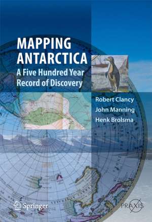
Structura volumului Mapping Antarctica propune o metodologie inversată față de lucrările istorice convenționale: aici, hărțile nu sunt simple anexe vizuale, ci devin pilonii centrali care dictează fluxul narațiunii. Organizată cronologic, lucrarea pornește de la conceptele cartografice timpurii ale lui Ptolemeu și Cook, trecând prin „Epoca Eroică” a explorărilor terestre, până la utilizarea aviației și tehnologiilor satelitare de după anul 2000. Această progresie permite cititorului să observe nu doar descoperirea geografică, ci și evoluția tehnică a modului în care percepem spațiul polar.
Ne-a atras atenția rigoarea cu care autorii Robert Clancy, John Manning și Henk Brolsma analizează tranziția de la mit la realitate științifică. Comparabil cu Of Maps and Men de John G. Weihaupt în ceea ce privește profunzimea cercetării, acest titlu se distinge prin actualizarea datelor pentru era modernă, incluzând impactul turismului și al noilor reglementări internaționale asupra reprezentării spațiale a continentului. Față de Antarctica de David Day, care se concentrează pe disputele politice și resurse, lucrarea de față pune accent pe instrumentarul tehnic și vizual al cunoașterii.
Această abordare academică se distanțează vizibil de alte lucrări ale lui Robert Clancy, precum The Hitchhiker's Guide to the Soul, demonstrând versatilitatea autorului în a trece de la explorări metafizice la cartografie tehnică riguroasă. Volumul publicat de Springer în seria Springer Praxis Books reușește să sintetizeze decenii de date colectate de Divizia Antarctică Australiană, oferind o perspectivă unică asupra modului în care „Continentul Șapte” a fost definit, măsurat și, în cele din urmă, înțeles prin lentila cartografiei profesionale.
Din seria Springer Praxis Books
-
 Preț: 251.12 lei
 -
 Preț: 289.78 lei
 -
 Preț: 212.55 lei
 -
 Preț: 208.45 lei
 -
 Preț: 324.12 lei
 -
 Preț: 227.21 lei
 - 15%
 Preț: 413.71 lei
 -
 Preț: 214.84 lei
 -
 Preț: 310.41 lei
 -
 Preț: 333.61 lei
 -
 Preț: 323.74 lei
 - 18%
 Preț: 911.62 lei
 -
 Preț: 221.64 lei
 -
 Preț: 208.77 lei
 -
 Preț: 312.64 lei
 -
 Preț: 210.21 lei
 -
 Preț: 256.19 lei
 -
 Preț: 260.26 lei
 -
 Preț: 301.35 lei
 -
 Preț: 351.38 lei
 -
 Preț: 227.17 lei
 -
 Preț: 281.23 lei
 -
 Preț: 159.75 lei
 - 18%
 Preț: 1256.95 lei
 - 18%
 Preț: 940.46 lei
 - 18%
 Preț: 975.90 lei
 - 18%
 Preț: 1250.20 lei
 - 18%
 Preț: 972.77 lei
 -
 Preț: 212.00 lei
 - 15%
 Preț: 632.63 lei
 -
 Preț: 306.63 lei
 -
 Preț: 306.08 lei
 -
 Preț: 299.26 lei
 -
 Preț: 246.55 lei
 -
 Preț: 219.27 lei
 -
 Preț: 380.74 lei
 -
 Preț: 213.48 lei
 -
 Preț: 245.29 lei
 -
 Preț: 248.41 lei
 -
 Preț: 257.95 lei
 -
 Preț: 340.09 lei
 -
 Preț: 208.76 lei
 -
 Preț: 330.21 lei
 -
 Preț: 322.04 lei
 -
 Preț: 152.20 lei
 -
 Preț: 295.76 lei
 -
 Preț: 314.30 lei
 -
 Preț: 106.06 lei
 - 18%
 Preț: 1178.23 lei
 -
 Preț: 298.45 lei
Preț: 464.80 lei
Carte tipărită la comandă
Livrare economică 29 august-04 septembrie
Specificații
ISBN-10: 9400743203
Pagini: 352
Ilustrații: XXI, 328 p. 163 illus., 130 illus. in color.
Dimensiuni: 173 x 246 x 25 mm
Greutate: 0.77 kg
Ediția:2014
Editura: Springer
Colecția Springer Praxis Books
Seria Springer Praxis Books
Locul publicării:Dordrecht, Netherlands
V-ar putea interesa
-
 Preț: 280.13 lei
 -
 -12%Preț: 219.23 lei248.40 leiRecomandat
 -
 -13%Preț: 210.22 lei243.01 lei
 -
 -13%Preț: 285.88 lei329.60 lei
 -
 The MapmakersJohn Noble WilfordPreț: 141.26 lei
 -
 Atlas of AtlasesPhilip Parker-22%Preț: 171.73 lei219.57 lei
 -
 To the Ends of the EarthPhilip Parker-21%Preț: 156.43 lei198.02 lei
 -
 40 Maps That Will Change How You See the WorldAlastair Bonnett-18%Preț: 119.99 lei146.01 lei
 -
 This Earthly GlobeAndrea di RobilantPreț: 91.84 lei
 -
 The Golden Atlas: The Greatest Explorations, Quests and Discoveries on MapsEdward Brooke-Hitching-15%Preț: 166.62 lei195.44 lei
 -
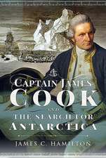 Captain James Cook and the Search for AntarcticaJames C. HamiltonPreț: 191.12 lei
 -
 -18%Preț: 263.94 lei322.39 lei
 -
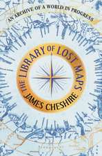 The Library of Lost MapsJames CheshirePreț: 266.96 lei
 -
 -20%Preț: 214.93 lei270.14 lei
 -
 -19%Preț: 74.93 lei92.44 lei
 -
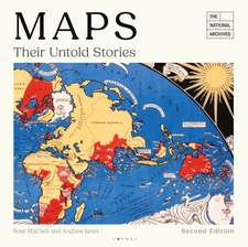 MapsRose Mitchell-27%Preț: 144.61 lei197.39 lei
 -
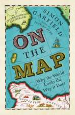 On The Map: Why the world looks the way it doesSimon Garfield-19%Preț: 75.42 lei93.34 lei
 -
 Mapping the North: Myth, Exploration, EncounterCharlotta ForssPreț: 207.28 lei
Public țintă
ResearchDe ce să citești această carte
Recomandăm această lucrare cercetătorilor și pasionaților de istoria științei care doresc o analiză factuală a explorării polare. Spre deosebire de jurnalele de călătorie, Mapping Antarctica oferă o perspectivă tehnică asupra modului în care tehnologia a modelat imaginea noastră despre acest continent. Veți câștiga o înțelegere profundă a evoluției cartografice, de la primele schițe maritime până la datele GPS moderne, totul sub girul unor experți de renume.
Despre autor
Robert Clancy este profesor emerit la Universitatea din Newcastle, Australia, fiind recunoscut pentru expertiza sa vastă care acoperă atât științele medicale, cât și istoria cartografiei. Împreună cu John Manning (Monash University) și Henk Brolsma (Australian Antarctic Division), acesta formează o echipă de autoritate în studiul regiunilor polare. Clancy este un colecționar pasionat de hărți vechi, pasiune care se reflectă în precizia și detaliul cu care abordează evoluția reprezentărilor geografice în lucrările sale academice publicate sub egida Springer.
Descriere scurtă
Cuprins
Arctic and Antarctic regions are not Poles apart.- The Reality: Cook to the International Geographical Congress.- The Heroic Age: Heroes, Legends and Land.- Wings over the Continent: From Wilkins to War.- A Second World War and a New Order of Business.- Antarctica Comes of Age: Windows of the World (1960–2000).- Post–2000: A new concept of mapping.- Tourism: A different explorer.
Recenzii
“Australia-based authors Clancy (Univ. of Newcastle), Manning (Monash Univ.), and Brolsma (Australian Antarctic Division) have produced a remarkable archive of maps of Antarctica with extensive annotation. … Annotations to each map, or group of maps, introduce fascinating detail rarely assembled in one place. … Summing Up: Recommended. Upper-division undergraduates through researchers/faculty; general readers.” (J. D. Ives, Choice, Vol. 52 (6), February, 2015)
“The fascinating book is about the discovery and exploration of Antarctica. … is a great read as it provides a comprehensive coverage of the story of Antarctica. It addresses a broad audience from modern cartographers as well as historic map collectors.” (bergbuch.info, March, 2014)
Notă biografică
John Manning has had a long career from 1956 to 2004 in surveying, mapping and geodesy in Antarctica and remote areas of Australia. This includes appointments as head of the Antarctic mapping Section of the Division of national mapping and eventually head of the Topographic Mapping Division, as well as chairman or secretary of the SCAR working group on Geodesy and Geographic information over 30 years until 2002.
He has been closely involved in modern Australian mapping of the Antarctic since 1966.
He has published some 120 technical papers on mapping cartography and photogrammetry. He was a contributing author to the "Readers Digest book on Antarctica". He retired from Geoscience Australia in 2004 as Group Leader Geodesy.
Henk Brolsma has had a professional career in surveying and mapping for more than 30 years in different parts of the world. Since 1994 , he has held the position of Mapping officer at the Australian Antarctic Division. In that role he has been in charge of the production of more than a hundred scale maps (small, medium as well as large) of the Australian Antarctic territory in East Antarctica. This also includes a variety oftopographic, thematic, bathymetric and satellite mapping. From 1996, he has been fundamentally involved in the establishment of the Australian Antarctic Data Centre and the extended development of its relational data base aspects. This includes an increasing use of aerial photography and satellite remote sensing, such as the application of digital terrain models for ice cap depiction for aviation operations. Today much of his work is involved with the design and delivery of digital online mapping, integrated with selected information such as nomenclature and remotely sensed imagery. He has been an Australian representative in the Scientific Committee for Antarctic research (SCAR) working groups for more than 10 years and is currently the elected chairman of the Standing Committee on Geographic Infrastructure.