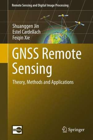
GNSS Remote Sensing: Remote Sensing and Digital Image Processing, cartea 19
Autor Shuanggen Jin, Estel Cardellach, Feiqin Xieen Limba Engleză Hardback – 15 oct 2013
Din seria Remote Sensing and Digital Image Processing
- 18%
 Preț: 1025.75 lei
 - 18%
 Preț: 1278.61 lei
 - 18%
 Preț: 908.14 lei
 - 15%
 Preț: 517.10 lei
 - 24%
 Preț: 1745.06 lei
 - 18%
 Preț: 1433.33 lei
 - 24%
 Preț: 899.50 lei
 - 15%
 Preț: 619.27 lei
 - 18%
 Preț: 1116.89 lei
 - 18%
 Preț: 1450.47 lei
 - 15%
 Preț: 678.37 lei
 - 20%
 Preț: 1421.32 lei
 - 24%
 Preț: 1642.07 lei
 - 18%
 Preț: 1460.38 lei
 - 20%
 Preț: 1068.77 lei
 - 18%
 Preț: 1131.94 lei
 - 18%
 Preț: 951.08 lei
 - 24%
 Preț: 919.39 lei
 - 18%
 Preț: 908.58 lei
 - 15%
 Preț: 623.33 lei
 - 15%
 Preț: 670.12 lei
 - 15%
 Preț: 611.43 lei
 - 15%
 Preț: 671.16 lei
Preț: 984.66 lei
Preț vechi: 1200.80 lei
-18%
Puncte Express: 1477
Carte tipărită la comandă
Livrare economică 23 noiembrie-07 decembrie
Livrare prin curier în România Termenul estimat este afișat lângă disponibilitate.
Transport gratuit pentru acest produs Plată online sau ramburs, în funcție de opțiunile comenzii.
Retur gratuit în 14 zile Comandă securizată și suport în română.
Specificații
ISBN-13: 9789400774810
ISBN-10: 9400774818
Pagini: 292
Ilustrații: XVI, 276 p. 102 illus., 56 illus. in color.
Dimensiuni: 160 x 241 x 22 mm
Greutate: 0.55 kg
Ediția:2014
Editura: Springer
Colecția Remote Sensing and Digital Image Processing
Seria Remote Sensing and Digital Image Processing
Locul publicării:Dordrecht, Netherlands
ISBN-10: 9400774818
Pagini: 292
Ilustrații: XVI, 276 p. 102 illus., 56 illus. in color.
Dimensiuni: 160 x 241 x 22 mm
Greutate: 0.55 kg
Ediția:2014
Editura: Springer
Colecția Remote Sensing and Digital Image Processing
Seria Remote Sensing and Digital Image Processing
Locul publicării:Dordrecht, Netherlands
V-ar putea interesa
-
 The Physics of GlaciersKurt M. Cuffey-29%Preț: 531.23 lei747.49 lei
 -
 Eriksen, A: Field GeophysicsJohn MilsomPreț: 265.10 lei
 -
 Seismic InterferometrySchuster Gerard ThomasPreț: 444.40 lei
 -
 Introduction to SeismologyPeter M. Shearer-11%Preț: 559.43 lei628.57 lei
 -
 3-D Seismic InterpretationM. Bacon-29%Preț: 376.76 lei533.04 lei
 -
 An Introduction to Our Dynamic PlanetNick Rogers-19%Preț: 471.28 lei581.83 lei
 -
 The LithosphereIrina Artemieva-14%Preț: 1357.40 lei1578.36 lei
 -
 -22%Preț: 461.65 lei589.77 lei
 -
 Physics of the EarthFrank Stacey-19%Preț: 710.28 lei876.89 lei
 -
 -23%Preț: 697.54 lei905.89 lei
 -
 Earthquake and Volcano DeformationPaul Segall-19%Preț: 695.94 lei859.18 lei
 -
 The Global Carbon CycleDavid ArcherPreț: 336.45 lei
 -
 Seismic InversionYanghua Wang-8%Preț: 579.60 lei629.99 lei
 -
 The PrincipiaIsaac NewtonPreț: 153.10 lei
Public țintă
ResearchCuprins
Introduction to GNSS.- Atmospheric delays and Multipath.- Ground-based GNSS Atmospheric Sensing.- Space-borne GNSS Atmospheric Sensing.- GNSS Reflectometry.- GNSS Ocean Remote Sensing.- GNSS Hydrology Sensing.- GNSS Cryosphere Sensing.
Recenzii
From the book reviews:
“The book shows the possibility of using GNSS technology for multidisciplinary research, which is addressed here to a wide audience, representing the community of GNSS, meteorologists, hydrologists and others, from the area of earth sciences. I highly recommend this book to students and researchers who wish to learn about how to think about new possibilities of using GNSS technology in monitoring of the earth.” (Jaroslaw Bosy, Pure and Applied Geophysics, Vol. 172, 2015)
“The book shows the possibility of using GNSS technology for multidisciplinary research, which is addressed here to a wide audience, representing the community of GNSS, meteorologists, hydrologists and others, from the area of earth sciences. I highly recommend this book to students and researchers who wish to learn about how to think about new possibilities of using GNSS technology in monitoring of the earth.” (Jaroslaw Bosy, Pure and Applied Geophysics, Vol. 172, 2015)
Notă biografică
Shuanggen Jin is Professor at the Shanghai Astronomical Observatory, CAS, and Professor and Dean at School of Remote Sensing and Geomatics Engineering, Nanjing University of Information Science and Technology, China. He received the B.Sc degree in Geodesy from Wuhan University in 1999 and the Ph.D degree in Geodesy from University of Chinese Academy of Sciences in 2003. His main research areas include Satellite Navigation, Remote Sensing, Space Geodesy, Climate Change and Space/Planetary Exploration. He has published over 400 papers in JGR, IEEE, EPSL, GJI, JG etc. with more than 4500 citations and H-index>40, 10 books/monographs and 8 patents/software copyrights. He has been President of International Association of Planetary Sciences (IAPS) (2013-2017), President of the International Association of CPGPS (2016-2017), Chair of IUGG Union Commission on Planetary Sciences (UCPS) (2015-2019), Vice-President of the IAG Commission 2 (2015-2019), Editor-in-Chief of International Journal of Geosciences (2010-), Associate Editor of IEEE Transactions on Geoscience and Remote Sensing (2014-), Journal of Navigation (2014-), Advances in Space Research (2013-2017), Editorial Board member of Remote Sensing (2017-), GPS Solutions (2016-), Journal of Geodynamics (2014-) and Planetary and Space Science (2014-). He has received 100-Talent Program of CAS (2010), Fellow of International Association of Geodesy (IAG) (2011), Jiangsu Distinguished Professor (2018), Fu Chengyi Award of Chinese Geophysical Society (2012), First Prize of Satellite Navigation and Positioning Progress Award (2017), Member of Russian Academy of Natural Sciences (2017-), First Prize of China Overseas Chinese Contribution Award (2018), Members of European Academy of Sciences (2018-), and Fellow of International Union of Geodesy and Geophysics (IUGG) (2019).
Textul de pe ultima copertă
The versatile and available GNSS signals can detect the Earth’s surface environments as a new, highly precise, continuous, all-weather and near-real-time remote sensing tool. This book presents the theory and methods of GNSS remote sensing as well as its applications in the atmosphere, oceans, land and hydrology. Ground-based atmospheric sensing, space-borne atmospheric sensing, reflectometry, ocean remote sensing, hydrology sensing as well as cryosphere sensing with the GNSS will be discussed per chapter in the book.
Caracteristici
Contains detailed theory and study cases to help the reader put the material into practice Contains a special chapter on next generation GNSS-RS, which is are seen as the future in GNSS Describes new potentials as well as advantages that complement existing techniques