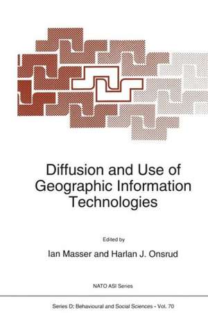
Diffusion and Use of Geographic Information Technologies: NATO Science Series D:, cartea 70
Editat de I. Masser, H.J. Onsruden Limba Engleză Paperback – 9 noi 2012
Din seria NATO Science Series D:
-
 Preț: 389.87 lei
 -
 Preț: 383.59 lei
 - 18%
 Preț: 982.89 lei
 -
 Preț: 375.07 lei
 - 18%
 Preț: 1176.72 lei
 -
 Preț: 403.19 lei
 - 18%
 Preț: 1265.21 lei
 - 18%
 Preț: 1172.30 lei
 - 5%
 Preț: 394.67 lei
 - 5%
 Preț: 359.75 lei
 -
 Preț: 397.25 lei
 - 18%
 Preț: 1262.27 lei
 - 15%
 Preț: 465.49 lei
 -
 Preț: 397.25 lei
 - 18%
 Preț: 1264.90 lei
 - 5%
 Preț: 2191.63 lei
 - 5%
 Preț: 2034.23 lei
 - 15%
 Preț: 656.84 lei
 - 18%
 Preț: 1891.22 lei
 -
 Preț: 385.99 lei
 -
 Preț: 396.60 lei
 - 18%
 Preț: 1277.10 lei
 - 18%
 Preț: 1884.15 lei
 - 18%
 Preț: 1888.18 lei
 - 18%
 Preț: 1752.82 lei
 -
 Preț: 390.96 lei
 - 18%
 Preț: 982.26 lei
 - 18%
 Preț: 1893.74 lei
 - 18%
 Preț: 1757.66 lei
 - 18%
 Preț: 1265.94 lei
 - 18%
 Preț: 1263.10 lei
 -
 Preț: 387.03 lei
 - 18%
 Preț: 1889.82 lei
 - 18%
 Preț: 1754.36 lei
 -
 Preț: 381.19 lei
 - 18%
 Preț: 1713.27 lei
 - 18%
 Preț: 1590.55 lei
 - 18%
 Preț: 1261.20 lei
 - 18%
 Preț: 1169.73 lei
 - 5%
 Preț: 380.40 lei
 - 18%
 Preț: 1269.42 lei
 - 15%
 Preț: 623.39 lei
 - 18%
 Preț: 1888.18 lei
Preț: 1172.48 lei
Preț vechi: 1429.86 lei
-18%
Puncte Express: 1759
Carte tipărită la comandă
Livrare economică 20 noiembrie-04 decembrie
Livrare prin curier în România Termenul estimat este afișat lângă disponibilitate.
Transport gratuit pentru acest produs Plată online sau ramburs, în funcție de opțiunile comenzii.
Retur gratuit în 14 zile Comandă securizată și suport în română.
Specificații
ISBN-13: 9789401047784
ISBN-10: 9401047782
Pagini: 364
Ilustrații: XI, 349 p.
Dimensiuni: 160 x 240 x 19 mm
Greutate: 0.51 kg
Ediția:Softcover reprint of the original 1st ed. 1993
Editura: SPRINGER NETHERLANDS
Colecția Springer
Seria NATO Science Series D:
Locul publicării:Dordrecht, Netherlands
ISBN-10: 9401047782
Pagini: 364
Ilustrații: XI, 349 p.
Dimensiuni: 160 x 240 x 19 mm
Greutate: 0.51 kg
Ediția:Softcover reprint of the original 1st ed. 1993
Editura: SPRINGER NETHERLANDS
Colecția Springer
Seria NATO Science Series D:
Locul publicării:Dordrecht, Netherlands
Public țintă
ResearchCuprins
Diffusion and Use of Geographic Information Technologies: An Introduction.- Diffusion and Use of Geographic Information Technologies: An Introduction.- The Diffusion of Innovations Model: Keynote Address.- The Diffusion of Innovations Model: Keynote Address.- Section 1: Research Methodology and Interdisciplinary Perspectives.- 1.1 Gaining User and Organisational Acceptance for Advanced Information Systems.- 1.2 Implementation of New Information Technology.- 1.3 Commentary on “Implementation of New Information Technology” by Paul Goodman.- 1.4 The Application of Research and Development from the Information Systems Field to GIS Implementation in Local Government: Some Theories on Successful Adoption and Use of GIS Technology.- 1.5 Implications from MIS Research for the Study of GIS Diffusion: Some Initial Evidence.- Section 2: Assessing and Modeling the Diffusion of Geographic Information Innovations.- 2.1 The Diffusion of GIS in British Local Government.- 2.2 GIS Implementation in British Local Government.- 2.3 Diffusion and Use of Geographic Information Systems in Public Sector Agencies in the United States.- 2.4 Correlating Adoption Factors and Adopter Characteristics with Successful Use of Geographic Information Systems.- 2.5 Embodied GIS -A Concept for GIS Diffusion.- 2.6 Comments on “Embodied GIS -A Concept for GIS Diffusion” by Peter R. Zwart.- Section 3: Assessing Cultural and Institutional Issues.- 3.1 ‘Universal’ GIS versus National Land Information Traditions: Software Imperialism or Endogenous Developments?.- 3.2 The Use of Geographic Information Technology in the City of Padova.- 3.3 Impact of GIS on a Southern European Country: The Case of Portugal.- 3.4 Geographic Information Technology as Appropriate Technology for Development.- Section 4:Mechanisms for Facilitating the Diffusion of GIS Technology.- 4.1 Developing the Spatial Information Marketplace: A Canadian Case Study.- 4.2 NEXPRI: A National Center to Support the Diffusion of Geographical Information Technology.- 4.3 Technology Transfer and Training Needs: The URSA-NET Experience.- 4.4 Urban and Regional Planning Models and GIS.- Section 5: Extending the Research Agenda.- Appendix: NATO Advanced Research Workshop Participants.