
Compact World Atlas: DK Reference Atlases
Autor DKen Limba Engleză Paperback – 2 mai 2018
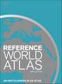
With 65 maps covering 196 countries, this atlas combines improved visual landscape modelling with key roads, railways, rivers, and settlements. Throughout, it interweaves traditional cartographic techniques and the latest digital technology.
Compact World Atlas has been updated to reflect recent geopolitical changes such as the annexation of Crimea, the Inuit place names in Canada, and the populations of Chinese towns.
Fact files on countries helps the reader understand facets of different nations including their population, religion, currency, while the comprehensive index-gazetteer of places and countries covers approximately 20,000 cross-referenced geographical names.
This comprehensive volume also features geographical comparisons such as the most sparsely populated countries, the ten richest countries, and the greatest waterfalls.
Truly encyclopaedic, the Compact World Atlas is a necessary companion for any bookshelf.


Preț: 66.01 lei
Preț vechi: 85.86 lei
-23%
Puncte Express: 99
Carte disponibilă
Livrare economică 13-25 noiembrie
Livrare prin curier în România Termenul estimat este afișat lângă disponibilitate.
Transport gratuit de la 400.00 lei Plată online sau ramburs, în funcție de opțiunile comenzii.
Retur gratuit în 14 zile Comandă securizată și suport în română.
Specificații
ISBN-13: 9780241317648
ISBN-10: 0241317649
Pagini: 192
Dimensiuni: 217 x 276 x 14 mm
Greutate: 0.78 kg
Editura: Dorling Kindersley - DK
Colecția DK
Seria DK Reference Atlases
Locul publicării:London, United Kingdom
ISBN-10: 0241317649
Pagini: 192
Dimensiuni: 217 x 276 x 14 mm
Greutate: 0.78 kg
Editura: Dorling Kindersley - DK
Colecția DK
Seria DK Reference Atlases
Locul publicării:London, United Kingdom
V-ar putea interesa
-
 The History of Emotions: A Very Short IntroductionThomas Dixon-19%Preț: 58.08 lei71.35 lei
-
 -16%Preț: 66.68 lei79.44 lei
-
 -21%Preț: 221.73 lei281.19 lei
-
 -16%Preț: 62.14 lei73.67 lei
-
 -13%Preț: 132.33 lei152.92 lei
-
 -16%Preț: 93.93 lei111.82 lei
-
 -14%Preț: 253.14 lei294.68 lei
-
 -15%Preț: 84.12 lei98.53 lei
-
 -19%Preț: 99.90 lei122.83 lei
-
 -15%Preț: 121.41 lei142.57 lei
-
 -18%Preț: 170.76 lei207.86 lei
-
 -15%Preț: 62.56 lei73.98 lei
-
 365 Ways to Save the Planet: A Day-by-day Guide to Sustainable LivingGeorgina Wilson-Powell-19%Preț: 86.59 lei106.55 lei
-
 -18%Preț: 89.12 lei108.07 lei
-
 -19%Preț: 164.85 lei203.63 lei
-
 Manifesting Happiness: How to Attract All Good ThingsEsther McCann-17%Preț: 60.62 lei73.16 lei
-
 -18%Preț: 41.44 lei50.63 leiRecomandat
-
 Preț: 63.95 lei
-
 Preț: 211.97 lei
-
 Preț: 63.71 lei
-
 Cooking For One For DummiesJennifer FisherPreț: 130.09 lei
-
 Journaling for DummiesAmber Lea StarfirePreț: 116.62 lei
-
 Body Language For Dummies, 4th EditionElizabeth KuhnkePreț: 138.55 lei
-
 Coaching & Mentoring for DummiesLeo MacLeodPreț: 138.57 lei
-
 College Research Papers For DummiesJoe GiampalmiPreț: 138.63 lei
-
 -21%Preț: 41.88 lei52.90 lei
Descriere
Descriere de la o altă ediție sau format:
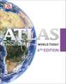
Colourful maps, flags and fascinating insights make this pocket sized atlas an ideal source of information about our ever changing world.
Arranged in two main sections - a world atlas and country factfile - the Pocket A-Z World Atlas provides an invaluable source of accurate, informative and interesting geographical information, all in one compact and affordable volume. The atlas section, arranged by continent, presents over 70 colourful, clearly labelled, easy-to-read regional maps showing all the world's nations, combining digital landscape modelling with the most important roads, railways, rivers, and settlements. Each map is annotated with fascinating 'insight' facts that reveal a wealth of amazing information from around the world.
The second section comprises a comprehensive series of country profiles, arranged alphabetically, covering all the essential facts and figures, including details of geography, climate, society, and economics. This section also contains reference factfile data for every nation, including the national flag, total area, population, languages, religions, and currency.
Dive straight in to discover:
- This new fully revised 8th Edition incorporating hundreds of updates to maps and statistics.
- 71 regional maps, 196 country profile maps, flags, and statistics.
- In-depth country profiles.
- Fully cross-referenced index/gazetteer.
Finding places is quick and convenient with a clearly-styled index of 7,000 atlas section place-names.
Ideal for family reference, crosswords, and quizzes, this atlas presents an intriguing and absorbing journey around the world in which we live.