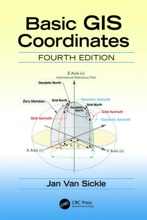
Basic GIS Coordinates
Autor Jan Van Sickleen Limba Engleză Hardback – 29 ian 2027
Features
- Explores the upcoming change in the basis for horizontal and vertical coordinate systems in North America.
- Covers the fundamentals of State Plane Coordinates and Universal Transverse Mercator Coordinates, heights, and the Public Land Surveying System.
- Explains the progression of the ideas that are the foundation of geospatial coordinate systems.
- Each chapter concludes with review questions and answers.
- Provides critical information needed to understand coordinate systems in GIS technology.
Preț: 671.38 lei
Preț vechi: 886.98 lei
-24% Precomandă
Puncte Express: 1007
Carte nepublicată încă
Livrare prin curier în România Precomanda se expediază când titlul devine disponibil.
Transport gratuit pentru acest produs Plată online sau ramburs, în funcție de opțiunile comenzii.
Retur gratuit în 14 zile Comandă securizată și suport în română.
Doresc să fiu notificat când acest titlu va fi disponibil:
Se trimite...
Specificații
ISBN-13: 9781041144779
ISBN-10: 1041144776
Pagini: 240
Ilustrații: 154
Dimensiuni: 156 x 234 mm
Ediția:4
Editura: CRC Press
Colecția CRC Press
ISBN-10: 1041144776
Pagini: 240
Ilustrații: 154
Dimensiuni: 156 x 234 mm
Ediția:4
Editura: CRC Press
Colecția CRC Press
Public țintă
Professional Practice & Development, Professional Training, and Undergraduate AdvancedCuprins
1. Foundation of a Coordinate System. 2. Building a Coordinate System. 3. Heights. 4. Two Coordinate Systems. 5. The Public Land Survey System of the United States.
Notă biografică
Jan Van Sickle has been a licensed Professional Land Surveyor for forty-three years and is currently licensed in Colorado, California, Oregon, Texas, North Dakota, West Virginia, and Pennsylvania. He supervised control work using the first commercial GPS receiver suitable for geodetic work, the Macrometer V-1000. He led the team that produced control positions for more than 120 cities around the world, assisted in the first GPS survey of the Grand Canyon, was involved in the BIM of the White House, gave technical assistance in the reconstruction of the geodetic network of Nigeria, managed the imagery and gravity analysis in the South Gobi, delivered the 2021 keynote at the NSPS URISA Summit, taught at Penn State and the University of Colorado, and was a member of the Royal Institute of Chartered Surveyors. Jan earned his Ph.D. in geospatial engineering from the University of Colorado. He is an ASPRS Certified Photogrammetrist and Mapping Scientist, Lidar and the Principal Geodetic Engineer at Maxar Technologies. Website: www.janvansickle.com
Descriere
The fourth edition of this popular book discusses important updates to surveying and mapping systems in North America. It provides current information, more practical exercises, and better explanations of recent changes and helps professionals and students understand modern surveying methods and stay compliant with new standards.
Recenzii
"Dr. Van Sickle has made yet another contribution to the field with this update on his popular book, Basic GIS Coordinates. As demonstrated with this book, he has a unique capability for explaining the complications and nuances of coordinate systems in an understandable manner. This book should have a prominent place in the library of the many people having a role in using coordinate systems for their work and everyday life."
—Lynn E. Johnson, University of Colorado, Denver, USA
"No GIS educator or practitioner should be without Basic GIS Coordinates. Jan Van Sickle explains some of our field’s most challenging, yet fundamental, concepts with unsurpassed clarity. His combination of long professional experience, deep study, and clear expression prepare him uniquely to create this invaluable reference work. Meanwhile, the impending replacement of North America’s primary horizontal and vertical datums add a new sense of urgency to this welcome 3rd edition."
—David DiBiase, Esri, Redlands, California, USA
"This book address the issue of accurately representing our 3D planet in a 2D forum. The author covers the traditional ways of representing location in X,Y, and Z space and the challenges with these techniques; and provides a comprehensive view of coordinate systems, datums, and other details associated with location description."
— Kumar Navulur, PhD, Frederick, Colorado, USA
"The Basic GIS Coordinates by Dr. Van Sickle has become a favorite book for many of my students. I would recommend this book to everybody who wants to learn the foundations of the coordinate systems, datums, and basic geodetic principals. There are several other books on this subject, but Basic GIS Coordinates stands above all of them for one simple reason: the genuine way of describing complex scientific principals in plain English without extensive heavy mathematics. I strongly recommend."
— Apostol Panayotov, University of Colorado, Denver, USA
"Basic GIS Coordinates is a ‘must have’ survival guide for everyone in this age of ubiquitous digital locations. Jan Van Sickle is the ultimate spatial adventurer with a lifetime of achievement who has ‘been there, done that, got the t-shirt and took a selfie.’ He informs, educates and guides the spatial consumer through the constructs, assumptions and limitations intrinsic to accurately representing the rough irregular surface of our 3-D world on flat 2-D surfaces, digital or otherwise. Navigating the uninitiated through key elements of coordinate systems, datums, reference frames, transformations, and earth models may loom daunting, but in Basic GIS Coordinates it is a pleasurable and enlightening journey. In stark contrast to the Alice in Wonderland truism ‘If you don’t know where you are going any road will get you there’, Jan Van Sickle clearly illuminates for the reader which road to pick, where it leads and how to consistently get there."
— Michael Harris, TigerShark Consulting, Livermore, Alabama, USA
"As with previous editions of this fine book, the pithy opening sentence of the first chapter states, ‘Coordinates are slippery devils.’ And indeed, they are. Coordinates are fundamental to GIS, and to the widespread – and rapidly growing – arena of positioning-based products and services. A solid understanding of coordinates requires a working knowledge of the underlying geodetic principles. That is no simple thing, and Jan Van Sickle again succeeds in adroitly explaining such complex and subtle concepts. New to this third edition is the important and timely topic of replacing the existing U.S. datums with a modern dynamic system in 2022. Perhaps most remarkable is that so much material is capably explained in such a slender volume. An accessible and engaging style is augmented with numerous clean, clear illustrations. The result is a book that should have a prominent place in the library of GIS professionals. And despite the book’s title, it can serve as a valuable reference to geospatial practitioners in other fields, from surveying and engineering to photogrammetry and remote sensing. In short, it will find an audience with anyone who works with and wants a better understanding of those ‘slippery devils’ – coordinates."
— Michael L. Dennis, Geodetic Analysis, LLC, Sedona, Arizona, USA
—Lynn E. Johnson, University of Colorado, Denver, USA
"No GIS educator or practitioner should be without Basic GIS Coordinates. Jan Van Sickle explains some of our field’s most challenging, yet fundamental, concepts with unsurpassed clarity. His combination of long professional experience, deep study, and clear expression prepare him uniquely to create this invaluable reference work. Meanwhile, the impending replacement of North America’s primary horizontal and vertical datums add a new sense of urgency to this welcome 3rd edition."
—David DiBiase, Esri, Redlands, California, USA
"This book address the issue of accurately representing our 3D planet in a 2D forum. The author covers the traditional ways of representing location in X,Y, and Z space and the challenges with these techniques; and provides a comprehensive view of coordinate systems, datums, and other details associated with location description."
— Kumar Navulur, PhD, Frederick, Colorado, USA
"The Basic GIS Coordinates by Dr. Van Sickle has become a favorite book for many of my students. I would recommend this book to everybody who wants to learn the foundations of the coordinate systems, datums, and basic geodetic principals. There are several other books on this subject, but Basic GIS Coordinates stands above all of them for one simple reason: the genuine way of describing complex scientific principals in plain English without extensive heavy mathematics. I strongly recommend."
— Apostol Panayotov, University of Colorado, Denver, USA
"Basic GIS Coordinates is a ‘must have’ survival guide for everyone in this age of ubiquitous digital locations. Jan Van Sickle is the ultimate spatial adventurer with a lifetime of achievement who has ‘been there, done that, got the t-shirt and took a selfie.’ He informs, educates and guides the spatial consumer through the constructs, assumptions and limitations intrinsic to accurately representing the rough irregular surface of our 3-D world on flat 2-D surfaces, digital or otherwise. Navigating the uninitiated through key elements of coordinate systems, datums, reference frames, transformations, and earth models may loom daunting, but in Basic GIS Coordinates it is a pleasurable and enlightening journey. In stark contrast to the Alice in Wonderland truism ‘If you don’t know where you are going any road will get you there’, Jan Van Sickle clearly illuminates for the reader which road to pick, where it leads and how to consistently get there."
— Michael Harris, TigerShark Consulting, Livermore, Alabama, USA
"As with previous editions of this fine book, the pithy opening sentence of the first chapter states, ‘Coordinates are slippery devils.’ And indeed, they are. Coordinates are fundamental to GIS, and to the widespread – and rapidly growing – arena of positioning-based products and services. A solid understanding of coordinates requires a working knowledge of the underlying geodetic principles. That is no simple thing, and Jan Van Sickle again succeeds in adroitly explaining such complex and subtle concepts. New to this third edition is the important and timely topic of replacing the existing U.S. datums with a modern dynamic system in 2022. Perhaps most remarkable is that so much material is capably explained in such a slender volume. An accessible and engaging style is augmented with numerous clean, clear illustrations. The result is a book that should have a prominent place in the library of GIS professionals. And despite the book’s title, it can serve as a valuable reference to geospatial practitioners in other fields, from surveying and engineering to photogrammetry and remote sensing. In short, it will find an audience with anyone who works with and wants a better understanding of those ‘slippery devils’ – coordinates."
— Michael L. Dennis, Geodetic Analysis, LLC, Sedona, Arizona, USA