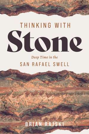
Thinking with Stone: Deep Time in the San Rafael Swell
Autor Brian Rajskien Limba Engleză Paperback – 18 dec 2026
In the San Rafael Swell, geologic forces have tilted and exposed the strata so that over 250 million years of geologic history can be observed simply by traveling across the rocky landscape, with its dramatic variety of colors and forms. Largely neglected by visitors to the state’s national parks and monuments and overlooked by many nature writers of the Colorado Plateau, the exceptional “Swell” offers a unique opportunity to think about people’s connections to the layers of earth beneath our feet.
Thinking with Stone takes readers on an intellectual journey across the Swell, moving from the youngest rocks at its edges to the oldest near its center and guiding readers through the features and histories of each geological layer. Drawing on personal experience and scientific research, Brian Rajski explores how creatively engaging with geology by using rocks as the foundation for thinking can generate new ideas about art, ethics, and the environment. Ultimately, the book reimagines the relationships between history and deep time, humanity and geology, and the individual and the stories told by stone.
Preț: 169.61 lei
Precomandă
Puncte Express: 254
Carte nepublicată încă
Livrare prin curier în România Precomanda se expediază când titlul devine disponibil.
Transport gratuit de la 400.00 lei Plată online sau ramburs, în funcție de opțiunile comenzii.
Retur gratuit în 14 zile Comandă securizată și suport în română.
Doresc să fiu notificat când acest titlu va fi disponibil:
Se trimite...
Specificații
ISBN-13: 9781647693169
ISBN-10: 1647693160
Pagini: 226
Ilustrații: 41 illus.
Dimensiuni: 152 x 229 mm
Ediția:First Edition
Editura: University of Utah Press
Colecția University of Utah Press
ISBN-10: 1647693160
Pagini: 226
Ilustrații: 41 illus.
Dimensiuni: 152 x 229 mm
Ediția:First Edition
Editura: University of Utah Press
Colecția University of Utah Press
Recenzii
“Thinking with Stone takes the reader to the otherworldly landscape of south-central Utah. Coming from the pen of an English professor who was raised in the San Rafael Swell, the book reconstructs the landscape of his childhood through the lens of geology and using literary prose and aesthetic photography. Stones, words, and imagery build the pages of this book. Visitors to San Rafael Swell will enjoy the landscape even more by learning about it, and this book offers a literary guide to the region.”—Rasoul Sorkhabi, University of Utah
Notă biografică
Brian Rajski is professor of English at Santa Monica College. He spent much of his childhood living in the small town of Orangeville, on the western edge of the geologic wonders of Utah’s San Rafael Swell.
Extras
Before stepping into the first of the San Rafael Swell’s strata, this chapter will dwell a bit longer on the surficial deposits at the San Rafael Swell’s outskirts in order to take a broad view over the entire Swell and to explain the methodology required to complete this intellectual survey of the Swell’s rocks. In particular, some general background on my experiences living by the Swell and the history of the area will provide helpful context for the specific stories and arguments later derived from each stratum. In addition, explanation of the role of geological maps and photographs in the researching and writing of this project will clarify the particular perspective I am bringing to the rocks in each subsequent chapter.
I grew up in Orangeville, Utah, part of Castle Valley, a narrow north-south strip of very small towns on or near the Highway 10 that runs along the west end of the San Rafael Swell, whose “castles” of rocks such as Windowblind Butte and San Rafael Knob give the area its name. Whereas the Highway 6 southeast from Price towards Moab can get quite busy with traffic heading from the urban Salt Lake City region to the outdoor and recreational areas of southern Utah, the two-lane Highway 10 remains a relatively quiet road that passes south from Price through the towns of Huntington, Castle Dale, Ferron, and Emery until it connects and ends with the I-70. A tiny handful of markets and humble restaurants dot what really could be considered these villages of Castle Valley, but there is little that would justify any outsider making a detour to them, despite the efforts by the officials of Emery County, which contains both Castle Valley and the San Rafael Swell, to encourage tourism to bring in more income to the county.
With the Wasatch Plateau towering thousands of feet higher on the west, the inhospitable flats and canyons of the San Rafael Swell on the east, Salt Lake City over two hours to the north, and half a state of rocky emptiness to the south, Castle Valley is arguably one of the more geographically isolated places in the country. Growing up surrounded by a land that was empty of humans and mostly impassable, especially in the winter months when the snow-covered Wasatch Plateau becomes hazardous to traverse, I certainly felt like I was living in the proverbial middle of nowhere. From a young age, I became acutely aware of our remoteness and began hatching plans to make an escape to anyplace that felt like somewhere, which meant attending a college, none of which, fortunately, could be found near home.
The town of Orangeville itself did little to combat this feeling of isolation and vacantness. Orangeville has a population that has historically hovered around 1,000 people over the last century. Living there in the 1980s, I was all too sensitive to the fact it lacked a single restaurant, coffee shop, or store except for the local gas and food market, which my older brother ended up proudly working at. For better or worse, commercial activity did not seem to exist in the town, especially for a child of my age. Both the small community swimming pool in nearby Castle Dale and the movie theater 10 miles north in Huntington provided me and my siblings some entertainment, though the theater usually only played films months after they had been released, a delay we had to sadly resign ourselves to whenever the summer blockbusters started to roll out. Unsurprisingly, we were always excited for family trips through the mountains up to Utah County and perhaps even Salt Lake City, where culture finally seemed available, in my case primarily in the form of comic books shops, where I would load up on superhero stories to get me through the next stretch back home.
Beyond school performances such as square dancing at Orangeville’s Cottonwood Elementary School, which I attended, the town’s public life heavily revolved around events at the local LDS chapel, perhaps the only other building of note in the town (the population being so low, the county’s two junior highs and single high school are distributed around other towns up to 15 miles away). Even when these gatherings were secular, such as Boy Scout troop meetings, the location as well as the inevitable prayers and role of religion made them less than welcoming for someone raised as a part of the very small non-Mormon community in the region. Any visit to the chapel involved the possibility of attempts to convert me to the church of the Latter-day Saints, so I was forced to become quite skilled and skeptical regarding theological matters before even reaching my teenage years. As a result, isolation from the religious center of this very religious community ultimately compounded my feelings of geographical isolation from the rest of humanity.
Thankfully, during those years I had two infinite resources to fall back on for company and support. The safety of the rural location meant that even from a young age I could freely wander not just the town but the open space around it by myself or in the company of a friend or sibling. Walking up Cottonwood Creek when its waters were low or hopping the fence in my backyard to explore the nearby fields full of sheep were two favorite activities. Most importantly for this book, bicycling aimlessly into the badlands that seemed to crowd around the town allowed me to completely escape into and immerse myself in the inhuman landscape to be found in the rest of the Swell. Just as important, Orangeville has a small library attached to the corner of the elementary school’s land. So when not venturing towards the edges of the Swell, I was busy reading and dreaming about living in the distant and, to my mind, more exciting places and communities described in the books I checked out in large quantities. At first, these were the completely imaginary worlds of science fiction and fantasy. Ironically, these books sometimes featured desert planets with landscapes uncannily similar to those of my own home, though seemingly far superior in my mind. Later, due to either exhausting the local library’s collection or maturing a bit, authors such as Dickens and Henry James opened up my awareness of a world of sophisticated European urbanity, something even more exotic and appealing to me than visiting another solar system. My eventual obtaining of a PhD. in English Literature and becoming an English professor no doubt also owe some of their origin to this period of desert exile. In any case, rocks and writing had a formidable influence on my development.
On the Utah Geological Survey map that covers Orangeville, much of the area of the town and its immediate vicinity is labeled as alluvial and surficial deposits, unconsolidated and uncemented material that is generally too recent and potentially fleeting to have a strong geological periodization. Like these Quaternary deposits on which they dwell, the current humans in the region feel like geologic latecomers who have been transported here from elsewhere and whose continued presence is tenuous, not so different from the infamous tumbleweeds, in reality an invasive species of Russian thistle, that would blow through town every year. Mormons were certainly hesitant to move to Castle Valley, and it was only in 1877 that Brigham Young, partially motivated by the need to consolidate Mormon power in the state against the influx of non-Mormons, ordered a group of followers to settle the area. Hard work and cooperation, reliance on seasonal flows of the creeks that flow down from the Wasatch Plateau, and many irrigation and reservoir projects have allowed for some agriculture to succeed, producing a thin expanse of farming (though mostly just of hay) around the towns that provides a green contrast to the neighboring geology for a few months each year. But the soil, formed from salty ancient seabeds, quickly becomes alkaline and unusable when irrigated. In the summer months when the temperature nears 100 degrees, it is always surprising to see white patches in the bare fields around the towns that look like snow but in reality are alkaline soils where little grows. As time passes, the future of agriculture and the government subsidies propping it up are increasingly in doubt across Emery County. Coal mining and power generation, the other major local economic industry, has a future equally in doubt as the mines and coal power plants close down and the world moves towards greener energy sources.
[end of excerpt]
I grew up in Orangeville, Utah, part of Castle Valley, a narrow north-south strip of very small towns on or near the Highway 10 that runs along the west end of the San Rafael Swell, whose “castles” of rocks such as Windowblind Butte and San Rafael Knob give the area its name. Whereas the Highway 6 southeast from Price towards Moab can get quite busy with traffic heading from the urban Salt Lake City region to the outdoor and recreational areas of southern Utah, the two-lane Highway 10 remains a relatively quiet road that passes south from Price through the towns of Huntington, Castle Dale, Ferron, and Emery until it connects and ends with the I-70. A tiny handful of markets and humble restaurants dot what really could be considered these villages of Castle Valley, but there is little that would justify any outsider making a detour to them, despite the efforts by the officials of Emery County, which contains both Castle Valley and the San Rafael Swell, to encourage tourism to bring in more income to the county.
With the Wasatch Plateau towering thousands of feet higher on the west, the inhospitable flats and canyons of the San Rafael Swell on the east, Salt Lake City over two hours to the north, and half a state of rocky emptiness to the south, Castle Valley is arguably one of the more geographically isolated places in the country. Growing up surrounded by a land that was empty of humans and mostly impassable, especially in the winter months when the snow-covered Wasatch Plateau becomes hazardous to traverse, I certainly felt like I was living in the proverbial middle of nowhere. From a young age, I became acutely aware of our remoteness and began hatching plans to make an escape to anyplace that felt like somewhere, which meant attending a college, none of which, fortunately, could be found near home.
The town of Orangeville itself did little to combat this feeling of isolation and vacantness. Orangeville has a population that has historically hovered around 1,000 people over the last century. Living there in the 1980s, I was all too sensitive to the fact it lacked a single restaurant, coffee shop, or store except for the local gas and food market, which my older brother ended up proudly working at. For better or worse, commercial activity did not seem to exist in the town, especially for a child of my age. Both the small community swimming pool in nearby Castle Dale and the movie theater 10 miles north in Huntington provided me and my siblings some entertainment, though the theater usually only played films months after they had been released, a delay we had to sadly resign ourselves to whenever the summer blockbusters started to roll out. Unsurprisingly, we were always excited for family trips through the mountains up to Utah County and perhaps even Salt Lake City, where culture finally seemed available, in my case primarily in the form of comic books shops, where I would load up on superhero stories to get me through the next stretch back home.
Beyond school performances such as square dancing at Orangeville’s Cottonwood Elementary School, which I attended, the town’s public life heavily revolved around events at the local LDS chapel, perhaps the only other building of note in the town (the population being so low, the county’s two junior highs and single high school are distributed around other towns up to 15 miles away). Even when these gatherings were secular, such as Boy Scout troop meetings, the location as well as the inevitable prayers and role of religion made them less than welcoming for someone raised as a part of the very small non-Mormon community in the region. Any visit to the chapel involved the possibility of attempts to convert me to the church of the Latter-day Saints, so I was forced to become quite skilled and skeptical regarding theological matters before even reaching my teenage years. As a result, isolation from the religious center of this very religious community ultimately compounded my feelings of geographical isolation from the rest of humanity.
Thankfully, during those years I had two infinite resources to fall back on for company and support. The safety of the rural location meant that even from a young age I could freely wander not just the town but the open space around it by myself or in the company of a friend or sibling. Walking up Cottonwood Creek when its waters were low or hopping the fence in my backyard to explore the nearby fields full of sheep were two favorite activities. Most importantly for this book, bicycling aimlessly into the badlands that seemed to crowd around the town allowed me to completely escape into and immerse myself in the inhuman landscape to be found in the rest of the Swell. Just as important, Orangeville has a small library attached to the corner of the elementary school’s land. So when not venturing towards the edges of the Swell, I was busy reading and dreaming about living in the distant and, to my mind, more exciting places and communities described in the books I checked out in large quantities. At first, these were the completely imaginary worlds of science fiction and fantasy. Ironically, these books sometimes featured desert planets with landscapes uncannily similar to those of my own home, though seemingly far superior in my mind. Later, due to either exhausting the local library’s collection or maturing a bit, authors such as Dickens and Henry James opened up my awareness of a world of sophisticated European urbanity, something even more exotic and appealing to me than visiting another solar system. My eventual obtaining of a PhD. in English Literature and becoming an English professor no doubt also owe some of their origin to this period of desert exile. In any case, rocks and writing had a formidable influence on my development.
On the Utah Geological Survey map that covers Orangeville, much of the area of the town and its immediate vicinity is labeled as alluvial and surficial deposits, unconsolidated and uncemented material that is generally too recent and potentially fleeting to have a strong geological periodization. Like these Quaternary deposits on which they dwell, the current humans in the region feel like geologic latecomers who have been transported here from elsewhere and whose continued presence is tenuous, not so different from the infamous tumbleweeds, in reality an invasive species of Russian thistle, that would blow through town every year. Mormons were certainly hesitant to move to Castle Valley, and it was only in 1877 that Brigham Young, partially motivated by the need to consolidate Mormon power in the state against the influx of non-Mormons, ordered a group of followers to settle the area. Hard work and cooperation, reliance on seasonal flows of the creeks that flow down from the Wasatch Plateau, and many irrigation and reservoir projects have allowed for some agriculture to succeed, producing a thin expanse of farming (though mostly just of hay) around the towns that provides a green contrast to the neighboring geology for a few months each year. But the soil, formed from salty ancient seabeds, quickly becomes alkaline and unusable when irrigated. In the summer months when the temperature nears 100 degrees, it is always surprising to see white patches in the bare fields around the towns that look like snow but in reality are alkaline soils where little grows. As time passes, the future of agriculture and the government subsidies propping it up are increasingly in doubt across Emery County. Coal mining and power generation, the other major local economic industry, has a future equally in doubt as the mines and coal power plants close down and the world moves towards greener energy sources.
[end of excerpt]
Cuprins
Acknowledgments
Introduction
1. The San Rafael Swell
2. The Gray World; or, a Childhood Among the Cretaceous: Mancos Shale
3. Extractive Entanglements: Ferron Sandstone
4. Colors from the Earth: Morrison Formation
5. Philomorphism: Entrada Sandstone
6. Igneous Intrusions: San Rafael Volcanic Field
7. The Lithic Archive: Navajo Sandstone
8. Superfluous Beauty: Wingate Sandstone
9. Necrogeomorphology: Chinle & Moenkopi Formations
10. Communing with the Inorganic: White Rim Sandstone
Appendix: San Rafael Swell Geology Driving Routes
Notes
Bibliography
Introduction
1. The San Rafael Swell
2. The Gray World; or, a Childhood Among the Cretaceous: Mancos Shale
3. Extractive Entanglements: Ferron Sandstone
4. Colors from the Earth: Morrison Formation
5. Philomorphism: Entrada Sandstone
6. Igneous Intrusions: San Rafael Volcanic Field
7. The Lithic Archive: Navajo Sandstone
8. Superfluous Beauty: Wingate Sandstone
9. Necrogeomorphology: Chinle & Moenkopi Formations
10. Communing with the Inorganic: White Rim Sandstone
Appendix: San Rafael Swell Geology Driving Routes
Notes
Bibliography