The Red Atlas: How the Soviet Union Secretly Mapped the World
Autor John Davies, Alexander J. Kent Cuvânt înainte de James Risenen Limba Engleză Hardback – 17 oct 2017
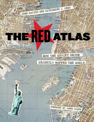
Subliniem faptul că The Red Atlas nu este doar un album de cartografie, ci o incursiune într-un proiect de supraveghere globală de o amploare fără precedent. Volumul, publicat de University of Chicago Press, cuprinde 272 de pagini și este susținut vizual de 282 de planșe color, oferind cititorului peste 350 de extrase din hărți care, timp de decenii, au fost strict secrete. Ne-a atras atenția rigoarea cu care armata sovietică a cartografiat nu doar metropole precum Londra sau New York, ci și orașe mici, înregistrând detalii tactice surprinzătoare: de la lățimea drumurilor la capacitatea portantă a podurilor.
Suntem de părere că structura cărții, organizată în patru capitole mari ce pornesc de la contextul istoric al lui Napoleon și ajung la prăbușirea URSS, transformă lectura într-o veritabilă poveste de detectiv. Capitolul dedicat simbolisticii și stilului cartografic este esențial pentru a înțelege cum vizualizau strategii sovietici lumea. Ca și A Cartographic Analysis of Soviet Military City Plans, lucrarea de față analizează planurile urbane militare, dar cu o metodologie care pune accent pe povestea umană și pe efortul de spionaj de la firul ierbii, nu doar pe analiza tehnică a hărților.
În contextul operei lui John Davies, această lucrare reprezintă o schimbare de paradigmă față de titluri precum A History of Wales, trecând de la istoria socială și culturală regională la o analiză geopolitică globală. Progresia narativă este susținută de apendice tehnice valoroase, care traduc glosarele și simbolurile rusești, oferind cititorului instrumentele necesare pentru a descifra singur aceste documente istorice fascinante.
Preț: 230.09 lei
Carte disponibilă
Livrare economică 13-27 august
Livrare express 29 iulie-04 august pentru 108.06 lei
Specificații
ISBN-10: 022638957X
Pagini: 272
Ilustrații: 282 color plates
Dimensiuni: 178 x 229 x 30 mm
Greutate: 0.77 kg
Ediția:1
Editura: University of Chicago Press
Colecția University of Chicago Press
V-ar putea interesa
-
 Preț: 217.24 lei
 -
 Towards the Semantic WebJohn Davies-20%Preț: 673.89 lei842.37 lei
 -
 Energy Landscapes, Inherent Structures, and Condensed-Matter PhenomenaFrank H Stillinger-19%Preț: 730.71 lei902.12 lei
 -
 Anna Letitia BarbauldWilliam MccarthyPreț: 367.98 lei
 -
 University ReformHans-Joerg TiedePreț: 269.31 lei
 -
 Knights of the RazorDouglas Walter BristolPreț: 209.00 lei
 -
 PainKeith Wailoo-5%Preț: 206.33 lei217.18 lei
 -
 Myth of the Birth of the HeroOtto RankPreț: 245.91 lei
 -
 Mind, the Body and the WorldTony AndersonPreț: 159.02 lei
De ce să citești această carte
Recomandăm această carte pasionaților de istorie militară și spionaj care doresc să descopere dimensiunea reală a Războiului Rece. Cititorul câștigă o perspectivă unică asupra modului în care Uniunea Sovietică vedea Occidentul, înțelegând că, înainte de Google Maps, exista deja un sistem de cartografiere incredibil de precis, realizat prin metode clandestine. Este un document istoric vizual rar, care transformă geografia într-un instrument de strategie politică.
Despre autor
John Davies este un cercetător și autor a cărui activitate diversă a acoperit teme variate, de la istoria socială complexă în A History of Wales până la reflecții spirituale și teologice. În The Red Atlas, el își folosește expertiza analitică pentru a documenta unul dintre cele mai ambițioase proiecte cartografice din istoria modernă. Alături de Alexander J. Kent, specialist în cartografie, Davies reușește să aducă la lumină documente care au fost ascunse publicului timp de decenii, combinând rigoarea academică cu o narațiune accesibilă despre supraveghere și geopolitica secolului XX.
Descriere scurtă
From 1950 to 1990, the Soviet Army conducted a global topographic mapping program, creating large-scale maps for much of the world that included a diversity of detail that would have supported a full range of military planning. For big cities like New York, DC, and London to towns like Pontiac, MI and Galveston, TX, the Soviets gathered enough information to create street-level maps. What they chose to include on these maps can seem obvious like locations of factories and ports, or more surprising, such as building heights, road widths, and bridge capacities. Some of the detail suggests early satellite technology, while other specifics, like detailed depictions of depths and channels around rivers and harbors, could only have been gained by actual Soviet feet on the ground. The Red Atlas includes over 350 extracts from these incredible Cold War maps, exploring their provenance and cartographic techniques as well as what they can tell us about their makers and the Soviet initiatives that were going on all around us.
A fantastic historical document of an era that sometimes seems less distant, The Red Atlas offers an uncanny view of the world through the eyes of Soviet strategists and spies.
Notă biografică
Cuprins
Note to Readers
Introduction
Why this book is a detective story
1 War and Peace
The background of the story—from Napoleon’s march on Moscow to the collapse of the Soviet Union
2 Capturing the World—on Paper
Describing the style, content, and symbology of the Red Army’s maps of the world
3 Plots and Plans
The overt and covert methods of the Soviet cartographers
4 Resurrection
The discovery of the maps after the fall of the Soviet Union and their continuing significance today
Acknowledgments
Appendix 1 Examples of Maps of Various Series and Scales
Appendix 2 References and Resources
Appendix 3 Translation of Typical City Plan Spravka
Appendix 4 Translation of Typical Topographic Map Spravka
Appendix 5 Symbols and Annotation
Appendix 6 Glossary of Common Terms and Abbreviations
Appendix 7 Print Codes
Appendix 8 Secrecy and Control
General Index
Place-Names Index