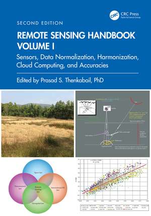
Remote Sensing Handbook, Volume I: Sensors, Data Normalization, Harmonization, Cloud Computing, and Accuracies: Remote Sensing Handbook
Editat de Prasad S. Thenkabailen Limba Engleză Hardback – 29 noi 2024
FEATURES
- Provides the most up-to-date comprehensive coverage of remote sensing science.
- Discusses and analyzes data from old and new generations of satellites and sensors.
- Provides comprehensive methods and approaches for remote sensing data normalization, standardization, and harmonization.
- Includes numerous case studies on advances and applications at local, regional, and global scales.
- Introduces advanced methods in remote sensing such as machine learning, cloud computing, and AI.
- Highlights scientific achievements over the last decade and provides guidance for future developments.
Preț: 1282.03 lei
Preț vechi: 1563.45 lei
-18%
Puncte Express: 1923
Carte tipărită la comandă
Livrare economică 14-28 septembrie
Livrare prin curier în România Termenul estimat este afișat lângă disponibilitate.
Transport gratuit pentru acest produs Plată online sau ramburs, în funcție de opțiunile comenzii.
Retur gratuit în 14 zile Comandă securizată și suport în română.
Specificații
ISBN-13: 9781032890951
ISBN-10: 1032890959
Pagini: 626
Ilustrații: 420
Dimensiuni: 178 x 254 mm
Greutate: 1.4 kg
Ediția:2
Editura: CRC Press
Colecția CRC Press
Seria Remote Sensing Handbook
ISBN-10: 1032890959
Pagini: 626
Ilustrații: 420
Dimensiuni: 178 x 254 mm
Greutate: 1.4 kg
Ediția:2
Editura: CRC Press
Colecția CRC Press
Seria Remote Sensing Handbook
Public țintă
Postgraduate, Professional Reference, and Undergraduate AdvancedCuprins
Part I: Earth Observing Satellites and Sensors from Different Eras and their Characteristics. 1. Remote Sensing Satellites and Sensors: Optical, Radar, LiDAR, Microwave, Hyperspectral, and UAVs. Part II: Global Navigation Satellite Systems (GNSS) and their Characteristics 2. Global Navigation Satellite Systems Theory and Practice: Evolution, State of Art, and Future Pathways. 3. Global Navigation Satellite System Reflectometry for Ocean and Land Applications. 4. Global Navigation Satellite Systems (GNSS) for a Wide Array of Terrestrial Applications. Part III: Fundamentals of Remote Sensing: Evolution, State-of-Art, and Future Possibilities. 5. Fundamentals of Remote Sensing for Terrestrial Applications: Evolution, Current State of Art, and Future Possibilities. Part IV: Data Normalization, Harmonization, and Inter-Sensor Calibration. 6. Overview of Satellite Image Radiometry in the Solar-Reflective Optical Domain. 7. Post-Launch Radiometric Calibration of Satellite-Based Optical Sensors with Emphasis on Terrestrial Reference Standard Sites. 8. Remote Sensing Data Normalization. 9. Satellite Data Degradations and their Impacts on High Level Products. Part V: Vegetation Index Standardization and Cross Calibration of Data from Multiple Sensors. 10. Inter- and Intra-sensor Spectral Compatibility and Calibration of the Enhanced Vegetation Indices. 11. Towards Standardisation of Vegetation Indices. Part VI: Crowdsourcing of Remote Sensing Data. 12. Crowdsourcing and Remote Sensing: Combining Two Views of the Earth. Part VII: Cloud Computing and Remote Sensing. 13. Processing Remote Sensing Data in Cloud Computing Environments. 14. Cloud Computing in Remote Sensing: A Comprehensive Assessment of State of Arts. Part VIII: Google Earth for Remote Sensing. 15. The Legacy of Google Earth in Remote Sensing. Part IX: Accuracies, Errors, and Uncertainties of Remote Sensing Derived Products. 16. Assessing Positional and Thematic Accuracies of Maps Generated from Remotely Sensed Data. Part X: Remote Sensing Law. 17. Remote Sensing Law: An Overview of its Development and its Trajectory in the Global Context. Part XI: Summary and Synthesis of Volume I. 18. Remote Sensing Handbook, Volume I: Sensors, Data Normalization, Harmonization, Cloud Computing, and Accuracies.
Notă biografică
Dr. Prasad S. Thenkabail, Senior Scientist (ST), United States Geological Survey (USGS), is a world-recognized expert in remote sensing science with major contributions in the field for nearly 40 years. He has made the list of the world’s top 1% of scientists across 22 scientific fields and 176 sub-fields. Dr. Thenkabail has conducted pioneering research in hyperspectral remote sensing of vegetation, global croplands, and their water use for food security. He obtained his PhD from the Ohio State University in 1992 and has 168 peer-reviewed publications including 15 books, including this six-volume set, and over 15 major data releases such as the Landsat-derived global cropland extent product @ 30m and Landsat-derived rainfed and irrigated cropland area product @ 30 m (LGRIP30). He was recognized as a Fellow of the American Society of Photogrammetry and Remote Sensing (ASPRS) in 2023. His scientific papers have won several awards for demonstrating world-class, highest-quality research. He was a Landsat Science Team Member (2007-2011).
Recenzii
The chapters in Remote Sensing Handbook are written by leading remote sensing scientists of the world and ably edited by Prasad S. Thenkabail, Senior Scientist, at U.S. Geological Survey (USGS) in Flagstaff, Arizona. The importance and the value of the Remote Sensing Handbook is clearly demonstrated by the need for a second edition. The Remote Sensing Handbook (First Edition, Volumes I-III) was published in 2014 and now after 10 years Remote Sensing Handbook, Second Edition, (Volumes I-VI) with 91 Chapters and nearly 3500 pages will be published. It is certainly monumental work in remote sensing science and for this I want to compliment Dr. Prasad Thenkabail. Remote sensing is now important to a large number of scientific disciplines beyond our community, and I recommend the Remote Sensing Handbook, Second Edition, Six Volume Set, to not only remote sensers but to the entire scientific community.
Dr. Compton Jim Tucker, Senior Scientist, Hydrospheric and Biospheric Laboratory, NASA Goddard Space Flight Center (GSFC), USA
It is not often that a Remote Sensing ‘Handbook’ containing rich and diverse contributions from some of the best researchers worldwide is compiled and published. So please take note that The Remote Sensing Handbook, Second Edition, edited by Dr Prasad S. Thenkabail has landed. This book contains everything you need to know to become a remote sensing scientist. The principles, the different wavelengths, the considerations to take into account for cloud processing, calibration and validation considerations and all the domain application areas you can possibly consider; some of which I was not even aware of, are all in there. Chapters of the book delve into topics such as space law and data for policy applications. Thank you to the authors for their contributions and commitment to ensure that this book becomes a very useful resource for researchers and students as the subject of Remote Sensing moves ahead with great pace into the 2nd quarter of the 21st Century.
Prof. Kevin J. Tansey, Editor-in-Chief, International Journal of Remote Sensing and Professor of Remote Sensing, University of Leicester, UK
This six-volume, Second Edition of the Remote Sensing Handbook provides a collection of chapters covering the gamut of remote sensing topics and applications. The chapters are written by many well-known members of the international remote sensing community, offering diverse perspectives on this rapidly developing discipline. The Handbook will be useful for students and practitioners alike. This compilation is a major undertaking and I congratulate Dr. Prasad Thenkabail on its completion.
Prof. Chris Justice, University of Maryland College Park, USA
Dr. Thenkabail and his colleagues do a brilliant job of condensing nearly 60 years of research and developments in remote sensing into a six-volume compendium. Interested in remote sensing, invest in this handbook!
Dr. Ramakrishna Nemani, Senior Earth scientist with the Advanced Supercomputing division at NASA Ames Research Center (retired), and Chief Developed of NASA Earth Exchange (NEX) platform
The second edition of the Remote Sensing Handbook is an impressive collection of 91 chapters in 6 volumes written by some of the best known and most active remote sensing scientists of our time. It is a vast expansion from its first edition of 3 volumes in 2015 and comprehensively covers all the major fields of remote sensing science, including sensors, image processing, information retrieval and a wide range of applications to ecology, agriculture, forestry, urban environment, water resources, climate change, etc. It allows students, scientists, professionals and practitioners to catch up with the rapid development in remote sensing technology, methodology and applications over the past decade. Dr. Prasad S. Thenkabail, a world-renowned remote sensing scientist, is highly commended for undertaking the daunting task of formulating and editing this large collection as the sole editor-in-chief. His 40-year experience in various remote sensing fields makes him well suited for this task.
Dr. Jing M. Chen, Editors-in-Chief of Remote Sensing of Environment, Professor, CRC, FRSC, University of Toronto, Canada
Descriere
Volume I of the Remote Sensing Handbook, Second Edition, is focused on satellites and sensors including Radar, LiDAR, Microwave, Hyperspectral, UAVs and their applications. It integrates discussions of remote sensing principles, data, methods, development, applications, and scientific and social context.