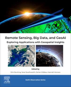
Remote Sensing, Big Data, and GeoAI: Exploring Applications with Geospatial Insights: Earth Observation
Editat de Erin Bunting, Jane Southworth, Cerian Gibbes, Hannah Herreroen Limba Engleză Paperback – 17 aug 2026
It also covers ethical and legal considerations, making it an invaluable resource for researchers, professionals, and students keen on using AI and Big Data techniques in remote sensing to solve complex geospatial challenges.
- Provides a full review of the development of Big Data and AI for remote sensing technologies, elucidating on how we have begun to incorporate data and methods, and highlighting potential areas of growth
- Approaches the content from a practical but immersive angle, allowing readers to understand common data and methodological approaches with real world examples
- Includes chapters on emerging topics of consideration, including the ethics/legality of using AI in remote sensing and how we teach such complex topics to students
Din seria Earth Observation
- 30%
 Preț: 781.43 lei
 - 31%
 Preț: 871.23 lei
 - 31%
 Preț: 817.58 lei
 - 31%
 Preț: 780.47 lei
 - 31%
 Preț: 800.77 lei
 - 31%
 Preț: 895.83 lei
 - 27%
 Preț: 758.78 lei
 - 32%
 Preț: 714.37 lei
 - 26%
 Preț: 894.33 lei
 - 31%
 Preț: 823.20 lei
 - 26%
 Preț: 867.78 lei
 - 26%
 Preț: 882.34 lei
 - 26%
 Preț: 866.85 lei
 - 31%
 Preț: 747.24 lei
 - 32%
 Preț: 727.65 lei
 - 26%
 Preț: 743.23 lei
 - 9%
 Preț: 970.02 lei
 - 31%
 Preț: 788.68 lei
 - 31%
 Preț: 854.37 lei
 - 31%
 Preț: 852.66 lei
 - 32%
 Preț: 841.57 lei
 - 31%
 Preț: 887.48 lei
 - 9%
 Preț: 787.28 lei
 - 32%
 Preț: 795.93 lei
 - 30%
 Preț: 964.29 lei
 - 32%
 Preț: 875.25 lei
 - 31%
 Preț: 914.82 lei
 - nou
 Preț: 739.84 lei
 - nou
 Preț: 880.19 lei
 - nou
 Preț: 865.76 lei
Preț: 964.02 lei
Preț vechi: 1175.63 lei
-18% Precomandă
Puncte Express: 1446
Carte nepublicată încă
Livrare prin curier în România Precomanda se expediază când titlul devine disponibil.
Transport gratuit pentru acest produs Plată online sau ramburs, în funcție de opțiunile comenzii.
Retur gratuit în 14 zile Comandă securizată și suport în română.
Doresc să fiu notificat când acest titlu va fi disponibil:
Se trimite...
Specificații
ISBN-13: 9780443267413
ISBN-10: 0443267413
Pagini: 592
Dimensiuni: 152 x 229 mm
Editura: ELSEVIER SCIENCE
Seria Earth Observation
ISBN-10: 0443267413
Pagini: 592
Dimensiuni: 152 x 229 mm
Editura: ELSEVIER SCIENCE
Seria Earth Observation
Cuprins
1. Big Data in Geospatial Context: Challenges and Opportunities
2. Fundamental of GeoAI: Common Approaches in Remote Sensing
3. Earth Observations and Satellite Imagery in a Big Data World
4. Big Data Remote Sensing and Data Acquisition and Preprocessing
5. Big Data Analytics for Geospatial Applications
6. GEOAI Algorithms and Techniques for Image Analysis
7. Integration of Remote Sensing, Big Data, and GeoAI
8. Remote Sensing and Big Data Applications in Agriculture
9. Remote Sensing and Big Data Applications in Water
10. Remote Sensing and Big Data Applications in Coastal Environmental
11. Remote Sensing and Big Data Applications in Environmental Management
12. Environmental Monitoring and Conservation Using Remote Sensing and Big Data
13. Disaster Management and Remote Sensing Applications
14. Spatial Data Visualization and Interpretation as it Pertains to Big Data, Remote Sensing, and GeoAI
15. Ethical and Legal Considerations in Remote Sensing and Big Data
16. How Citizen Science and New Technologies can Integrate with Big Data
17. Bringing Big Data and GeoAI into the Classroom: Preparing Undergraduate and Graduate Students for the Future of Geospatial Research
18. Future Trends and Emerging Technologies in Remote Sensing, Big Data, and GeoAI