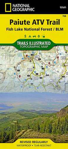
Paiute ATV Trail: Trails Illustrated Other Rec. Areas
Autor National Geographic Mapsen Limba Engleză Sheet map, folded – 2 aug 2012
- Waterproof - Tear-Resistant - Topographic Map
With over 2,500 miles of trails and roadways available for motorized use, Fishlake National Forest is an extraordinary destination for Off Highway Vehicle (OHV) enthusiasts. National Geographic's Trails Illustrated map of Paiute ATV Trail combines unmatched detail with helpful information to offer an invaluable tool for exploring this remarkable region of Utah.
- Created in partnership with local land management agencies, this expertly researched map features key areas of interest including the Tushar Mountains, Piute and Otter Creek reservoirs, the Pavant Range, Fremont Indian State Park, and a portion of Fish Lake.
- In addition to the Paiute ATV Trail, the map includes portions of the Great Western Trail and the Fillmore, Marysvale, and Richfield ATV loops.
- Trails are clearly marked according to difficulty and with mileage between intersections to help you plan your excursions.
- The print version of the map includes over a dozen town access maps that include the services available in each town.
The map base includes contour lines and elevations for summits, passes and lakes. Many recreation features are noted as well, including campgrounds, trailheads, interpretive trails, boat launches, and fishing areas.
Every Trails Illustrated map is printed on "Backcountry Tough" waterproof, tear-resistant paper. A full UTM grid is printed on the map to aid with GPS navigation.
Other features found on this map include: Angle, Antimony, Awapa Plateau, Beaver, Burrville, Circleville, Circleville Mountain, Cove Fort (historical), Delano Peak, Elsinore, Fillmore, Fish Lake, Fishlake National Forest, Flowell, Glenwood, Greenwich, Hatton, Joseph, Junction, Kanosh, Kingston, Koosharem, Manderfield, Marysvale, Meadow, Monroe, Pahvant Range, Parker Mountain, Piute County, Piute Reservoir, Redmond, Richfield, Salina, Sevier, Sigurd, Sulphurdale, Tushar Mountains.
- Map Scale = 1:90,000
- Sheet Size = 37.75" x 25.5"
- Folded Size = 4.25" x 9.25"
Preț: 69.20 lei
Disponibil
Livrare economică 28 octombrie-11 noiembrie
Specificații
ISBN-10: 1566953081
Pagini: 1
Dimensiuni: 108 x 235 x 5 mm
Greutate: 0.09 kg
Editura: National Geographic Maps Division
Colecția National Geographic Maps Division
Locul publicării:Washington, United States
V-ar putea interesa
-
 The London Mapguide (8th Edition)Michael Middleditch-22%Preț: 54.83 lei69.86 lei
 -
 Israel: Travel Maps International Adventure MapNational Geographic MapsPreț: 71.27 lei