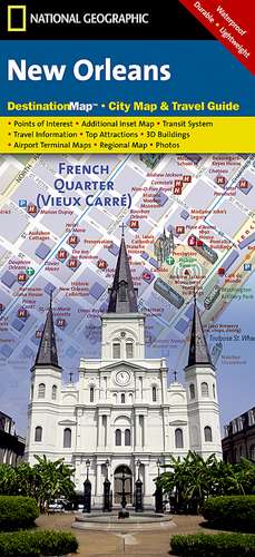
New Orleans: Destination City Maps
Autor National Geographic Mapsen Limba Engleză Sheet map, folded – 13 dec 2010
- Waterproof - Tear-Resistant - Travel Map
Whether you're seeking the jazz and nightlife of the French Quarter or want to take in the many museums and galleries in the Warehouse/Arts District, National Geographic's City Destination map of New Orleans will help you make the most of your visit. The front side of this map is loaded with information on points of interest in and around New Orleans including a map of Louisiana plantations.
- A map of the region and a diagram of Louis Armstrong New Orleans International Airport provide additional tools for navigating the area.
- A detailed street map of the city is shown on the reverse side.
- Hundreds of points of interest including monuments, parks, theaters, churches, hotels, visitor centers, and more are easy to find with the multi-language legend.
Transportation aids such streetcars, shuttles, and ferries will prove invaluable in traversing the city using public transit. Additional services such as police stations, post offices, and hospitals are included as well.
Every City Destination map is printed on "Travel-Tough" waterproof, tear-resistant paper.
- Map Scale = 1:8,200
- Sheet Size = 17.75" x 24.75"
- Folded Size = 4" x 8.75"
Preț: 45.61 lei
Disponibil
Livrare economică 19 octombrie-02 noiembrie
Specificații
ISBN-10: 1597754145
Pagini: 1
Dimensiuni: 105 x 225 x 23 mm
Greutate: 0.05 kg
Editura: National Geographic Maps Division
Colecția National Geographic Maps Division
Locul publicării:United States