
Maps & Civilization
Autor Norman J. W. Throweren Limba Engleză Paperback – dec 2007
In this concise introduction to the history of cartography, Norman J. W. Thrower charts the intimate links between maps and history from antiquity to the present day. A wealth of illustrations, including the oldest known map and contemporary examples made using Geographical Information Systems (GIS), illuminate the many ways in which various human cultures have interpreted spatial relationships.
The third edition of Maps and Civilization incorporates numerous revisions, features new material throughout the book, and includes a new alphabetized bibliography.
Praise for previous editions of Maps and Civilization:
“A marvelous compendium of map lore. Anyone truly interested in the development of cartography will want to have his or her own copy to annotate, underline, and index for handy referencing.”—L. M. Sebert, Geomatica
Preț: 272.22 lei
Puncte Express: 408
Preț estimativ în valută:
48.15€ • 56.28$ • 41.86£
48.15€ • 56.28$ • 41.86£
Carte indisponibilă temporar
Specificații
ISBN-13: 9780226799742
ISBN-10: 0226799743
Pagini: 362
Ilustrații: 71 halftones, 23 line drawings
Dimensiuni: 159 x 226 x 23 mm
Greutate: 0.49 kg
Ediția:3rd edition
Editura: University of Chicago Press
ISBN-10: 0226799743
Pagini: 362
Ilustrații: 71 halftones, 23 line drawings
Dimensiuni: 159 x 226 x 23 mm
Greutate: 0.49 kg
Ediția:3rd edition
Editura: University of Chicago Press
V-ar putea interesa
-
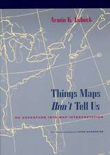 Things Maps Don't Tell Us: An Adventure into Map InterpretationArmin K. LobeckPreț: 276.16 lei
 -
 Flattening the Earth: Two Thousand Years of Map ProjectionsJohn P. SnyderPreț: 305.89 lei
 -
 The Piri Reis Map of 1513Gregory C McIntoshPreț: 351.34 lei
 -
 Un Voyage En Palestine, 1884, Impressions Et SouvenirsLéon-Henri NéretPreț: 169.95 lei
 -
 Voyage À La Guadeloupe: Oeuvre PosthumeFélix LonginPreț: 184.19 lei
 -
 Voyage À VénusAchille EyraudPreț: 162.63 lei
 -
 Voyage Aux Pays MystérieuxLouis JacolliotPreț: 155.29 lei
 -
 Preț: 96.94 lei
 -
 Voyage Dans La Péninsule Du SinaïVictor Lottin de LavalPreț: 125.53 lei
 -
 Voyage Dans l'Amérique Méridionale. Tome 3, Partie 1Alcide D' OrbignyPreț: 206.57 lei
 -
 Voyage Dans Les Déserts Du Sahara, Par Un Officier d'Administration Aux ColoniesAdrien-Jacques FolliePreț: 112.15 lei
 -
 Preț: 192.47 lei
 -
 Preț: 199.39 lei
 -
 Preț: 184.77 lei
 -
 Voyage Dans l'Intérieur de l'Afrique Et Au Cap de Bonne-EspéranceFrançois LevaillantPreț: 222.11 lei
 -
 Preț: 76.79 lei
 -
 Preț: 76.06 lei
 -
 Preț: 258.32 lei
 -
 Preț: 184.57 lei
 -
 Preț: 177.64 lei
 -
 Preț: 161.89 lei
 -
 Voyage Du Sultan Abd-Ul-Aziz de Stamboul Au CaireLouis GardeyPreț: 199.23 lei
 -
 Preț: 83.56 lei
 -
 Voyage d'Une Femme Autour Du Monde. 2e ÉditionIda PfeifferPreț: 258.32 lei
 -
 Voyage En AlgérieAlbert MeunierPreț: 125.91 lei
 -
 Voyage En Égypte Et En Palestine: Notes Et SouvenirsErnest JacquessonPreț: 111.42 lei
 -
 Preț: 162.83 lei
 -
 Preț: 236.22 lei
Notă biografică
Norman J. W. Thrower is professor emeritus of geography at the University of California, Los Angeles. His other books include Standing on the Shoulders of Giants: A Longer View of Newton and Halley, Sir Francis Drake and the Famous Voyage, 1577–1580, and Original Survey and Land Subdivision.
Cuprins
Preface
ONE
ONE
Introduction: Maps of Preliterate Peoples
TWO
TWO
Maps of Classical Antiquity
THREE
THREE
Early Maps of East and South Asia
FOUR
Cartography in Europe and Islam in the Middle Ages
FIVE
The Rediscovery of Ptolemy and Cartography in Renaissance Europe
SIX
Cartography in the Scientific Revolution and the Enlightenment
SEVEN
Diversification and Development in the Nineteenth Century
EIGHT
Modern Cartography: Official and Quasi-Official Maps
NINE
Modern Cartography: Private and Institutional Maps
APPENDIX A
Selected Map Projections
APPENDIX B
Short List of Isograms
APPENDIX C
Glossary
Notes
Illustration Sources
Bibliography
Index