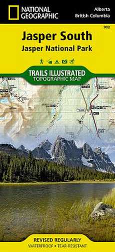
Jasper South: Trails Illustrated National Parks
Autor National Geographic Mapsen Limba Engleză Sheet map, folded – 2 aug 2012
- Waterproof - Tear-Resistant - Topographic Map
The largest park in the Canadian Rockies, Jasper National Park is a UNESCO World Heritage Site with breathtaking mountain scenery and bountiful recreational opportunities. Expertly researched and created in cooperation with Parks Canada and others, National Geographic's Trails Illustrated map of Jasper South provides outdoor enthusiasts unparalleled detail of the region.
- The map covers the park from the town of Jasper and the Victoria Cross Ranges in the north to its southern boundary and includes such popular points of interest as Athabasca and Sunwapta Falls, Maligne Canyon and Lake, Icefield Centre, and Medicine Lake.
- Also covered are the neighboring Mount Robson, Whitehorse Wildland and Hamber Provincial Parks and the northwestern corner of Banff National Park with the Colombia Icefield.
- Explore the area by following the map to trailheads and then along precisely mapped trails, labeled with distance markers and according to designated usage, whether hiking, biking, horseback riding or ATVing.
- Popular scenic roads are shown as well, including Highway #93A, Yellowhead Highway, Maligne Road and the spectacular Icefields Parkway, shown with distance markers, scenic pullouts and facilities alongside the road.
To aid in your navigation the map shows glaciers and icefields, contour lines and elevations, labeled peaks and passes and water features. Recreation points of interest include campgrounds and primitive camps, backcountry lodging and cabins, river access and boat launch points, horse stables and corrals, downhill ski areas and scenic viewpoints.
Every Trails Illustrated map is printed on "Backcountry Tough" waterproof, tear-resistant paper. A full UTM grid is printed on the map to aid with GPS navigation.
- Map Scale = 1:100,000
- Sheet Size = 25.5" x 37.75"
- Folded Size = 4.25" x 9.25"
Preț: 69.33 lei
Disponibil
Livrare economică 19 octombrie-02 noiembrie
Specificații
ISBN-10: 1566956609
Pagini: 1
Dimensiuni: 108 x 235 x 5 mm
Greutate: 0.09 kg
Editura: National Geographic Maps Division
Colecția National Geographic Maps Division
Locul publicării:Washington, United States
