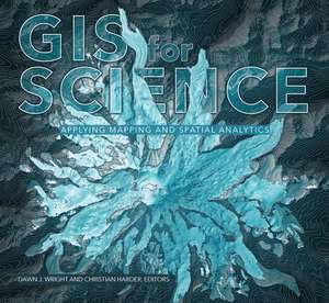
GIS for Science: Applying Mapping and Spatial Analytics: GIS for Science
Autor Dawn J. Wright, Christian Harderen Limba Engleză Paperback – 14 aug 2019
Această ediție din seria GIS for Science marchează o tranziție importantă în literatura de specialitate, trecând de la simpla cartografiere la aplicarea riguroasă a conceptului „The Science of Where®”. Observăm o structură bazată pe studii de caz reale, care demonstrează cum platforma ArcGIS și sistemele cloud ArcGIS Online transformă datele brute în soluții pentru probleme globale stringente. Volumul introduce capitole noi ce explorează utilizarea dronelor în arheologie și monitorizarea impactului schimbărilor climatice asupra ghețarilor, oferind o perspectivă tehnică actualizată asupra fluxurilor de lucru geospațiale.
Abordarea aleasă de Dawn J. Wright și Christian Harder pune accent pe interdisciplinaritate. Considerăm că relevanța acestui text pentru curriculumul de geografie și științele mediului rezidă în capacitatea de a sintetiza date provenite de la sateliți, nave și senzori remoti într-un cadru analitic unitar. GIS for Science: Applying Mapping and Spatial Analytics acoperă aceeași arie tematică precum Addressing Earth's Challenges, dar cu o orientare mult mai aplicată spre integrarea analiticii spațiale în procesul de luare a deciziilor științifice. În timp ce alte lucrări, precum Geographical Information Science de George P. Petropoulos, se concentrează pe algoritmi și metode de teledetecție, volumul de față prioritizează colaborarea și comunicarea rezultatelor prin hărți derivate din date complexe, făcând tehnologia accesibilă unei audiențe vaste, de la profesioniști la cercetători amatori.
Preț: 329.46 lei
Carte disponibilă
Livrare economică 01-15 iunie
Specificații
ISBN-10: 1589485300
Pagini: 252
Dimensiuni: 279 x 249 x 15 mm
Greutate: 1.11 kg
Editura: Esri Press
Seria GIS for Science
V-ar putea interesa
-
 Introduction to Microwave Remote SensingIain H. Woodhouse-18%Preț: 928.32 lei1132.09 lei
 -
 GIS in Public Health PracticeMassimo Craglia-5%Preț: 1586.08 lei1669.55 lei
 -
 Expert Systems and Geographic Information Systems for Impact AssessmentAgustin Rodriguez-Bachiller-15%Preț: 579.21 lei681.42 lei
 -
 GIS for Coastal Zone ManagementDarius Bartlett-18%Preț: 1207.75 lei1472.86 lei
 -
 -27%Preț: 753.87 lei1032.70 lei
 -
 Geographic Information Systems in Water Resources EngineeringLynn E. Johnson-18%Preț: 1212.91 lei1479.15 lei
 -
 Collaborative Geographic Information SystemsShivanand Balram-19%Preț: 551.98 lei681.45 lei
 -
 OpenstreetmapJonathan Bennett-20%Preț: 235.89 lei294.86 lei
 -
 Introduction to Sensors for Ranging and ImagingGraham Brooker-18%Preț: 853.02 lei1040.27 lei
 -
 Proceedings of UASG 2019Kamal Jain-18%Preț: 1175.73 lei1433.82 lei
 -
 Satellite Radiothermovision of Atmospheric ProcessesDmitry M. Ermakov-18%Preț: 955.82 lei1165.63 lei
 -
 Geospatial Technology for Human Well-Being and HealthFazlay S. Faruque-24%Preț: 963.09 lei1267.23 lei
 -
 Springer Handbook of Global Navigation Satellite SystemsPeter Teunissen-18%Preț: 2097.19 lei2557.55 lei
 -
 Preț: 392.21 lei
 -
 -18%Preț: 961.40 lei1172.44 lei
 -
 -18%Preț: 1356.40 lei1654.14 lei
 -
 -24%Preț: 736.80 lei969.46 lei
 -
 -20%Preț: 603.74 lei754.68 lei
 -
 -18%Preț: 901.93 lei1099.91 lei
De ce să citești această carte
Această carte este esențială pentru cei care doresc să vadă cum GIS-ul rezolvă probleme de mediu și sociale în lumea reală. Cititorul câștigă o înțelegere practică a modului în care analiza spațială susține sustenabilitatea globală. Este un instrument de inspirație și un ghid metodologic pentru oricine utilizează platforma ArcGIS în cercetare, oferind exemple concrete de utilizare a tehnologiilor emergente, precum dronele și analiza cloud.
Despre autor
Dawn J. Wright este un om de știință recunoscut la nivel internațional, ocupând funcția de Chief Scientist la Esri. Expertiza sa în oceanografie și GIS este completată de Christian Harder, un autor experimentat și fondator al Esri Press, care a documentat evoluția tehnologiei GIS de peste trei decenii. Împreună, aceștia aduc în GIS for Science o viziune care îmbină rigoarea academică cu expertiza tehnică de vârf în domeniul sistemelor informatice geografice.
Descriere scurtă
GIS for Science brings to life a collection of real-world examples of scientists using geographic information systems (GIS) to expand our understanding of the world. They are part of a global effort to find ways to sustain a livable environment for all life on the planet. At Esri, we call this The Science of Where®, a concept that merges our impulse to dream, discover, and understand with the rigor and discipline of the scientific process and the foundation of geography. As such, GIS provides a framework for applying science to almost every human endeavor as we aspire to transform the world through mapping and analytics.
The stories in this book are written for professional scientists, the swelling ranks of citizen scientists, and anyone interested in science and geography. The contributors represent a cross section of scientists who employ data gathered from satellites, aircraft, ships, drones, and myriad other remote-sensing technologies. This data is brought to life with GIS to study a range of issues relevant to our understanding of planet Earth and beyond. Scientists are documenting an array of geographically oriented issues ranging from climate change, natural disasters, and loss of biodiversity to political strife, disease outbreaks, and resource shortages.
The examples in this collection show how ArcGIS® software and the ArcGIS® Online cloud-based system work as a comprehensive geospatial platform to support research, collaboration, spatial analysis, and communication across many settings and communities. In these chapters, you'll learn about research on the effects of climate change on glaciers, advances in drone-based archaeological methods, the creation of a data-derived map of the world's ecosystems, efforts to preserve iconic avian habitats, and much more. These stories present GIS ideas and inspiration that users can apply across many disciplines, making this volume relevant to diverse scientific audiences.