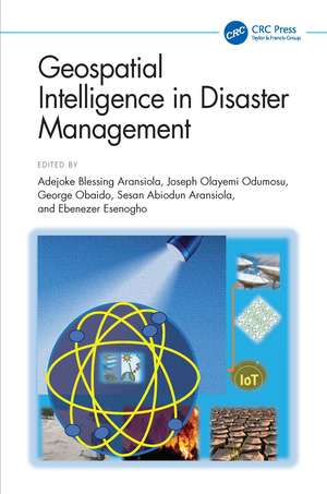
Geospatial Intelligence in Disaster Management: The AI Mapping Approach
Editat de Adejoke Blessing Aransiola, Joseph Olayemi Odumosu, George Obaido, Sesan Abiodun Aransiola, Ebenezer Esenoghoen Limba Engleză Hardback – 17 dec 2026
The book focuses on deep learning techniques for image-based disaster mapping and predictive modeling, alongside current advances, research tools, and applications ranging from environmental observation to social sensing. Beyond the technology, it addresses critical challenges such as ethical considerations and future research directions, offering a balanced perspective on the opportunities and limitations of AI-driven disaster management.
Designed for policymakers, researchers, and emergency responders, it provides groundbreaking strategies to predict, prevent, and respond to environmental disasters with unparalleled speed and accuracy.
Preț: 818.63 lei
Preț vechi: 1162.13 lei
-30% Precomandă
Puncte Express: 1228
Carte nepublicată încă
Livrare prin curier în România Precomanda se expediază când titlul devine disponibil.
Transport gratuit pentru acest produs Plată online sau ramburs, în funcție de opțiunile comenzii.
Retur gratuit în 14 zile Comandă securizată și suport în română.
Doresc să fiu notificat când acest titlu va fi disponibil:
Se trimite...
Specificații
ISBN-13: 9781041305620
ISBN-10: 1041305621
Pagini: 352
Ilustrații: 108
Dimensiuni: 156 x 234 mm
Ediția:1
Editura: CRC Press
Colecția Chapman and Hall/CRC
ISBN-10: 1041305621
Pagini: 352
Ilustrații: 108
Dimensiuni: 156 x 234 mm
Ediția:1
Editura: CRC Press
Colecția Chapman and Hall/CRC
Public țintă
Postgraduate and Professional ReferenceCuprins
Section 1: Introductions: Overview, Disaster Risk Reduction and Management 1. Geospatial Intelligence in Disaster Management: Overview 2. AI Mapping principles in disaster response 3. Geospatial Risk Assessment for Disaster Management 4. AI-Enhanced Flood Risk Mapping for Disaster Reduction 5. Geospatial Analysis of Landslide Hazard and Susceptibility Mapping 6. Real-Time Geospatial Mapping for Disaster Response Section 2: Applications of AI, Machine Learning in Disaster managements and Case Studies 7. Post-disaster damage assessment and management: AI Techniques 8. Microbial Technologies in Disaster Management 9. Geospatial data analysis using machine learning for managing disaster 10. Geospatial Modelling of Microbial Water Contamination in Disaster-Affected Environments 11. Computer vision techniques for remote sensing, hazard detection and predictive modelling 12. Harnessing geospatial intelligence for hurricane response and recovery 13. Adopting Geospatial analysis for wildfire risk assessment and management Section 3: Challenges and Future Perspectives 14. Constraints and shortcomings of AI Mapping in Disaster management 15. Future Guidelines for Geospatial Intelligence in Managing Disaster Scope
Notă biografică
Adejoke Blessing Aransiola is an emerging academic and researcher in the field of Geoinformatics, with a strong focus on environmental sustainability and climate change. She earned her Bachelor of Technology (B.Tech) degree in 2015 and her Master of Technology (M.Tech) degree in 2023, both in Remote Sensing, from the Department of Surveying and Geoinformatics, School of Environmental Technology, Federal University of Technology, Minna, Niger State, Nigeria. She is currently pursuing a Doctor of Philosophy (PhD) at the same institution, where her research investigates the intersection of climate change and agriculture—specifically, the monitoring of heatwaves and their impact on agricultural productivity in North-Central Nigeria.
Dr. Joseph Olayemi Odumosu is a Nigerian-born geospatial scientist and Registered Surveyor who holds a PhD in Surveying and Geoinformatics from the Federal University of Technology, Minna. His doctoral research focused on the development of homogenised gravity datasets for gravimetric geoid modelling in Nigeria. He is currently a Senior Lecturer in the Department of Land and Spatial Science (Geomatics Division) at the Namibia University of Science and Technology (NUST), Windhoek, where his research spans geodesy, photogrammetry, remote sensing, GIS, and machine learning applications for environmental monitoring and mineral resource assessment. He has authored over 40 journal articles and book chapters, and has supervised five MSc theses to completion while currently co-supervising two PhD candidates.
Dr. George Obaido is a researcher whose interests span Artificial Intelligence (AI), Machine Learning (ML), Deep Learning, Explainable AI (XAI), Responsible AI, Data Science, and their applications in healthcare, education, finance, and sustainable development. His work focuses on developing interpretable, transparent, and fairness-aware AI systems for high-impact domains, including disease diagnosis, clinical decision support, financial analytics, and social good initiatives. Through his research, he seeks to advance the responsible adoption of AI by improving model explainability, mitigating bias, and promoting trustworthy decision-making in real-world applications.
Dr. Sesan Abiodun Aransiola is an accomplished environmental microbiologist, academic leader, and postdoctoral research fellow whose work sits at the critical intersection of microbial biotechnology, waste management, and artificial intelligence. Currently serving as a Lecturer in the Department of Microbiology at both the University of Abuja, Nigeria, Dr. Aransiola has built a distinguished career defined by innovative solutions for soil and water remediation, sustainable agriculture, and the bioremediation of pollutants. Dr. Aransiola earned his Bachelor of Technology (BTech), Master of Technology (MTech), and Doctor of Philosophy (Ph.D) in Environmental Microbiology from the Federal University of Technology, Minna, Nigeria. His broader research portfolio spans environmental health, marine resources, and the bioremediation of diverse pollutants, consistently emphasizing practical, ecologically sound interventions.
Prof. Ebenezer Esenogho (NRF C2 Rated) is a highly accomplished academic and researcher with a distinguished career spanning close to two decades. He holds a Diploma in Computer Engineering (Upper Division, 2002/2003), a Bachelor of Engineering degree in Computer Engineering (Second Class Honours, Upper Division, 2007/2008), and a Master of Engineering in Electronics Engineering (2010/2011) from the University of Benin, Nigeria. Prof. Ebenezer lectured at the University of Benin, where he rose to the rank of Senior Lecturer. Prof. Ebenezer is a registered Engineer in Nigeria, and a member of the South African Institute of Electrical Engineers (SAIEE), IEEE Region 8, and several other professional bodies. His contributions to academia, research, and mentorship continue to inspire and shape the future of engineering and technology in Sub-Saharan Africa.
Dr. Joseph Olayemi Odumosu is a Nigerian-born geospatial scientist and Registered Surveyor who holds a PhD in Surveying and Geoinformatics from the Federal University of Technology, Minna. His doctoral research focused on the development of homogenised gravity datasets for gravimetric geoid modelling in Nigeria. He is currently a Senior Lecturer in the Department of Land and Spatial Science (Geomatics Division) at the Namibia University of Science and Technology (NUST), Windhoek, where his research spans geodesy, photogrammetry, remote sensing, GIS, and machine learning applications for environmental monitoring and mineral resource assessment. He has authored over 40 journal articles and book chapters, and has supervised five MSc theses to completion while currently co-supervising two PhD candidates.
Dr. George Obaido is a researcher whose interests span Artificial Intelligence (AI), Machine Learning (ML), Deep Learning, Explainable AI (XAI), Responsible AI, Data Science, and their applications in healthcare, education, finance, and sustainable development. His work focuses on developing interpretable, transparent, and fairness-aware AI systems for high-impact domains, including disease diagnosis, clinical decision support, financial analytics, and social good initiatives. Through his research, he seeks to advance the responsible adoption of AI by improving model explainability, mitigating bias, and promoting trustworthy decision-making in real-world applications.
Dr. Sesan Abiodun Aransiola is an accomplished environmental microbiologist, academic leader, and postdoctoral research fellow whose work sits at the critical intersection of microbial biotechnology, waste management, and artificial intelligence. Currently serving as a Lecturer in the Department of Microbiology at both the University of Abuja, Nigeria, Dr. Aransiola has built a distinguished career defined by innovative solutions for soil and water remediation, sustainable agriculture, and the bioremediation of pollutants. Dr. Aransiola earned his Bachelor of Technology (BTech), Master of Technology (MTech), and Doctor of Philosophy (Ph.D) in Environmental Microbiology from the Federal University of Technology, Minna, Nigeria. His broader research portfolio spans environmental health, marine resources, and the bioremediation of diverse pollutants, consistently emphasizing practical, ecologically sound interventions.
Prof. Ebenezer Esenogho (NRF C2 Rated) is a highly accomplished academic and researcher with a distinguished career spanning close to two decades. He holds a Diploma in Computer Engineering (Upper Division, 2002/2003), a Bachelor of Engineering degree in Computer Engineering (Second Class Honours, Upper Division, 2007/2008), and a Master of Engineering in Electronics Engineering (2010/2011) from the University of Benin, Nigeria. Prof. Ebenezer lectured at the University of Benin, where he rose to the rank of Senior Lecturer. Prof. Ebenezer is a registered Engineer in Nigeria, and a member of the South African Institute of Electrical Engineers (SAIEE), IEEE Region 8, and several other professional bodies. His contributions to academia, research, and mentorship continue to inspire and shape the future of engineering and technology in Sub-Saharan Africa.
Descriere
This book explores the integration of geospatial intelligence and artificial intelligence in disaster management, with a focus on unconventional mapping approaches. It examines how location-based data, satellite imagery, and deep learning converge to create real-time, predictive mapping tools that save lives.