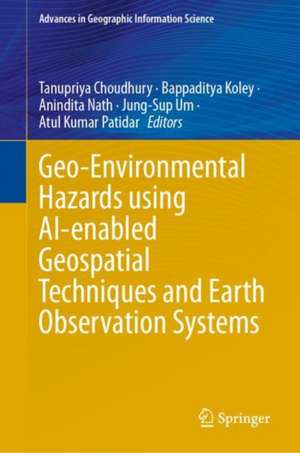
Geo-Environmental Hazards using AI-enabled Geospatial Techniques and Earth Observation Systems: Advances in Geographic Information Science
Editat de Tanupriya Choudhury, Bappaditya Koley, Anindita Nath, Jung-Sup Um, Atul Kumar Patidaren Limba Engleză Hardback – 28 mai 2024
Găsim în ediția 2024 a volumului Geo-Environmental Hazards using AI-enabled Geospatial Techniques and Earth Observation Systems o sinteză actualizată a modului în care algoritmii de învățare automată transformă monitorizarea mediului. Față de abordările anterioare, această lucrare pune accentul pe integrarea sistemelor de Inteligență Artificială (AI) cu datele provenite de la Sistemele de Observare a Pământului (EOS), oferind un cadru tehnic pentru evaluarea riscurilor naturale în timp real. Apreciem modul în care textul trece de la principiile teoretice ale teledetecției la aplicații extrem de specifice, cum ar fi modelarea evoluției liniei țărmului în zonele de cuibărit ale țestoaselor marine.
Această lucrare extinde cadrul propus de Geospatial Technology for Environmental Hazards de Pravat Kumar Shit, aducând date noi din perioada post-pandemică și punând un accent mai mare pe optimizarea hiperparametrilor în modelele de tip ansamblu (bagging și boosting). Structura este una progresivă, de la introducerea în aplicațiile AI (Capitolul 1) până la analize complexe de mediu. Găsim secțiuni dedicate analizei temperaturii suprafeței oceanice și concentrației de clorofilă-a, elemente esențiale pentru înțelegerea sănătății ecosistemelor marine, completând astfel viziunea autorilor din lucrări precum Geospatial Techniques in Climate Change Monitoring and Environmental Mapping.
În contextul operei editorilor, acest volum reprezintă o evoluție firească de la Machine Intelligence and Data Science Applications, aplicând concepte de știință a datelor direct în geografia fizică și geologia mediului. Cartea documentează riguros procese precum eroziunea solului în Etiopia sau inundațiile rapide din regiunile muntoase, oferind soluții de management durabil bazate pe dovezi geospațiale precise.
Din seria Advances in Geographic Information Science
- 18%
 Preț: 1119.28 lei
 - 24%
 Preț: 724.18 lei
 - 24%
 Preț: 656.13 lei
 - 15%
 Preț: 616.24 lei
 - 18%
 Preț: 1393.65 lei
 - 18%
 Preț: 917.91 lei
 - 15%
 Preț: 616.28 lei
 - 15%
 Preț: 621.21 lei
 - 18%
 Preț: 918.54 lei
 - 18%
 Preț: 959.88 lei
 - 15%
 Preț: 621.78 lei
 - 15%
 Preț: 648.78 lei
 - 18%
 Preț: 1084.76 lei
 - 15%
 Preț: 651.53 lei
 - 18%
 Preț: 1270.88 lei
 - 18%
 Preț: 915.54 lei
 - 18%
 Preț: 1140.84 lei
 - 18%
 Preț: 960.67 lei
 - 18%
 Preț: 905.27 lei
 - 15%
 Preț: 611.27 lei
 - 18%
 Preț: 818.67 lei
 - 18%
 Preț: 859.33 lei
 - 24%
 Preț: 1088.06 lei
 - 24%
 Preț: 1090.65 lei
 - 24%
 Preț: 1318.72 lei
 - 24%
 Preț: 1075.30 lei
 - 24%
 Preț: 1069.60 lei
Preț: 864.31 lei
Preț vechi: 1054.04 lei
-18%
Carte disponibilă
Livrare economică 29 octombrie-12 noiembrie
Specificații
ISBN-10: 3031537629
Pagini: 308
Ilustrații: XVII, 308 p. 161 illus., 137 illus. in color.
Dimensiuni: 155 x 235 mm
Greutate: 0.68 kg
Ediția:2024
Editura: Springer Nature Switzerland
Colecția Springer
Seria Advances in Geographic Information Science
Locul publicării:Cham, Switzerland
V-ar putea interesa
-
 Preț: 344.27 lei
 -
 Remote Sensing and Image InterpretationThomas Lillesand-18%Preț: 1345.99 lei1641.45 lei
 -
 Practical and Theoretical GeoarchaeologyPaul Goldberg-23%Preț: 642.56 lei834.49 lei
 -
 -24%Preț: 656.13 lei863.32 lei
 -
 AnthropogeomorphologyGouri Sankar Bhunia-24%Preț: 928.61 lei1221.87 lei
 -
 Spatial Modelling of Flood Risk and Flood HazardsBiswajeet Pradhan-24%Preț: 1021.92 lei1344.63 lei
 -
 Environmental Applications of Remote Sensing and GIS in LibyaHamdi A. Zurqani-18%Preț: 892.53 lei1088.44 lei
 -
 Monitoring and Managing Multi-hazardsJayanta Das-18%Preț: 1021.88 lei1246.19 lei
 -
 Geospatial Practices in Natural Resources ManagementPravat Kumar Shit-18%Preț: 973.94 lei1187.72 lei
 -
 Crisis on the Coast and HinterlandAshis Kumar Paul-18%Preț: 766.88 lei935.22 lei
 -
 Surface, Sub-Surface Hydrology and ManagementSubodh Chandra Pal-18%Preț: 1102.59 lei1344.62 lei
 -
 Environmental Risk and Resilience in the Changing WorldSwapan Talukdar-18%Preț: 980.87 lei1196.19 lei
 -
 New Advancements in Geomorphological ResearchJayanta Das-18%Preț: 1138.76 lei1388.73 lei
 -
 -20%Preț: 1414.10 lei1767.62 lei
 -
 Abbay River BasinAssefa MelessePreț: 484.00 lei
 -
 -15%Preț: 625.75 lei736.17 lei
 -
 Geospatial Techniques for Managing Environmental ResourcesJay Krishna Thakur-15%Preț: 624.77 lei735.03 lei
 -
 Preț: 437.99 lei
 -
 Flood Risk ManagementBrototi Biswas-18%Preț: 967.48 lei1179.85 lei
 -
 Geospatial and Soft Computing TechniquesP. V. Timbadiya-18%Preț: 1357.19 lei1655.11 lei
De ce să citești această carte
Această lucrare este esențială pentru cercetătorii și inginerii care doresc să stăpânească intersecția dintre AI și teledetecție. Cititorul câștigă acces la metodologii avansate de cartografiere a hazardelor, de la alunecări de teren la degradarea costieră, primind un instrumentar tehnic direct aplicabil în politici de mediu și strategii de reziliență. Este un ghid practic pentru utilizarea datelor satelitare în atenuarea amenințărilor geo-ecologice contemporane.
Despre autor
Coordonat de un colectiv de experți precum Tanupriya Choudhury și Bappaditya Koley, acest volum reflectă o expertiză vastă în inginerie, geografie și știința computerelor. Tanupriya Choudhury are o activitate recunoscută în domeniul inteligenței mașinilor și aplicațiilor data science, contribuind anterior la lucrări fundamentale despre telemedicină și monitorizarea schimbărilor climatice. Colectivul de editori reunește perspective academice din instituții internaționale, specializându-se în utilizarea tehnologiilor geospațiale pentru rezolvarea problemelor complexe de mediu și sustenabilitate.
Cuprins
Notă biografică
Prior to this role, he served Symbiosis International University, Pune, India; Graphic Era Hill University, Dehradun (Research Professor), UPES Dehradun (Professor and Research Head Informatics), Amity University Noida (Assistant Professor Grade 3 and International Dept. Head), and other prestigious academic institutions (Dronacharya College of Engineering Gurgaon, Lingaya’s University Faridabad, Babu Banarsi Das Institute of Technology Ghaziabad, Syscon Solutions Pvt. Ltd. Kolkata, etc.). He was recently recognized for his outstanding contributions to education with the Global Outreach Education Award for Excellence in Best Young Researcher Award at Global Outreach Education Award for Excellence (GOEAC) 2018.
His areas of expertise encompass Human Computing, Soft Computing, Cloud Computing, and Data Mining, among others. Notably accomplished within his field thus far is filing 25 patents and securing copyrights for 16 software programs from MHRD (Ministry of Human Resource Development). He has actively participated as an attendee or speaker at numerous National and International conferences across India and abroad. With more than 100 research papers (Scopus) authored to date on record, Dr. Choudhury has also been invited as a guest lecturer or keynote speaker at esteemed institutions such as Jamia Millia Islamia University, Maharaja Agersen College (Delhi University), Duy Tan University Vietnam, etc. He has also contributed significantly to various conferences throughout India serving roles like TPC member and session chairperson.
As an active professional within the technical community, Dr. Choudhury holds a lifetime membership with IETA (International Engineering & Technology Association) along with being affiliated with IEEE (Institute of Electrical and Electronics Engineers), IET (UK) (Institution of Engineering & Technology, UK), and other reputable technical societies. Additionally, he is associated with corporate entities and serves as a Technical Adviser for Deetya Soft Pvt. Ltd., Noida, IVRGURU, and Mydigital360. He is also serving as an editor in reputed journals.
He currently serves as the Honorary Secretary in IETA (Indian Engineering Teacher’s Association-India), alongside his role as the Senior Advisor Position in INDO-UK Confederation of Science, Technology and Research Ltd., London, UK, and International Association of Professional and Fellow Engineers-Delaware-USA.
Bappaditya Koley is currently working as Head of the Department of Geography at Bankim Sardar College, West Bengal, India. In 2021, he successfully obtained his PhD degree in Science from Jadavpur University, Kolkata, India. His areas of research interest include applied geomorphology, geo-informatics, natural hazards and disasters, climate change, coastal management, environmental issues, land use modeling, and sustainable development. He has also completed a minor research project on “Forestry, Fishery and Sustainable Livelihood: An Assessment for some selected areas of Indian Sunderbans” as a co-director, funded by the Indian Council of Social Science Research (ERC, Kolkata), Govt. of India. As a centre co-coordinator at Bankim Sardar College, he conducted two courses in Indian Institute of Remote Sensing (IIRS) Outreach Programmes during 2019–2023, organized by the Indian Institute of Remote Sensing (ISRO), Dehradun. He has also contributed several national and international research articles and book chapters in international reputed. He has been associated as the reviewer of some reputable journals published by Elsevier, Springer-Nature, and Taylor & Francis. He has been associated as a Guest Editor of the Special Issue “Designing of AIML (Artificial Intelligence and Machine Learning) and Convolutional Neural Network (CNN) Based Architectures and Its Various Applications in the Field of Engineering” under Designs, an open access journal by Multidisciplinary Digital Publishing Institute (MDPI).
Anindita Nath is currently working as a faculty in the Department of Geography at Bankim Sardar College, West Bengal, India. In the year 2021, she obtained her PhD degree in Science from Jadavpur University, Kolkata. Her research interests include coastal hazards and management, geospatial application, climate change, land degradation and management, landslide hazards and management, flood assessment and riverbank erosion, land use modeling, environmental issues, and sustainable development. She has published numerous research papers in leading national and international journals and book chapters to international reputations. She is associated as the reviewer of reputed journals published by Elsevier and Springer-Nature.
Jung-Sup Um Professor, Department of Geography, College of Social Sciences, Kyungpook National University, South Korea. He works as an Editor-in-Chief of Spatial Information Research (Springer-Nature) since 2015. He shares his interest in drones by maintaining strong links with international editorial boards, authors, and reviewer communities. He was awarded Outstanding Research Award 13 times for significant and lasting research contributions. He is also the author of a recent book on Drones as Cyber-Physical Systems, Concepts and Applications for the Fourth Industrial Revolution, coauthor of seven books on Spatial Information, and the author of more than 100 journal publications (including two patents registered). He has tried to promote the importance of drones as a core infrastructure of the 4th Industrial Revolution era while offering online lectures on the contents of this book. His current research work is on unmanned aerial vehicle (UAV) remote sensing as a cyber-physical system, the use of satellite data (Greenhouse Gases Observing Satellite (GOSAT), Orbiting Carbon Observatory-2 (OCO-2)) for UN-REDD (United Nations’ collaborative program on “Reducing Emissions from Deforestation and Forest Degradation”) MRV (Measurement, Reporting and Verification) requirements, and synergistic application research that combines with various disciplines such as law, economics, political science, environmental science, etc. As a photographer and remote sensing practitioner, he began to intensively occupy himself with drones by the revolutionary prospect of being able to take aerial photographs at any time or any place. Over time, a great deal of enthusiasm for this technology let him publish a book about drones (2019, Springer-Nature). He was a principal investigator in the various research projects that led to promoting geographic information to the general public. He was the program co-chair of the Organizing Committee of FOSS4G (Free and Open-Source Software for Geospatial) Seoul from 2013 to 2015. He was an associate editor and member of the editorial board of Spatial Information Research from 1995 to 2015. He worked as a government official in the Ministry of Environment in Korea, with a focus on the application of remote sensing and geographic information system (GIS). His experience includes projects with related central governments in Korea, and he is frequently invited as a consultant for zero-carbon Geomatics planning to local and central governments.
Atul Kumar Patidar completed his BSc degree (1998–2001) at the Holkar Science College (DAVV) Indore, Madhya Pradesh, India, followed by an MSc degree in Geology (2001–2003) at the same institute. In the year 2010, he obtained his PhD degree from the M.S. University of Baroda, Vadodara, Gujarat, India. During his doctoral studies, he worked on the neotectonic evolution of the southern mainland Kachchh basin using ground penetrating radar (GPR) and remote sensing techniques. He has reconstructed the chronology of paleoseismic events (timing and magnitude) and comprehended the reasons for recurrent seismic activity along the Katrol Hill Fault. He established fault segmentation and scarp retreat model for the active faults of the Kachchh basin.
Dr. Patidar has 15+ years of experience in both industry and academia. As an exploration geoscientist, he has spent 11 years (2007–2018) in Reliance Industries Limited, a multinational hydrocarbon exploration and production company in India. In 2018, he joined the Department of Petroleum Engineering and Earth Sciences, University of Petroleum and Energy Studies, Dehradun, as a Sr. Associate Professor (Industry Fellow). Dr. Patidar has accomplished numerous national and international projects during his corporate tenure in the areas of regional-scale basin analysis and 3D seismic interpretation. He has received numerous awards for his contribution to industry, academia, and research. His core areas of specialization are Geoinformatics, Tectonic Geomorphology, Neotectonics, Paleoseismology, GPR, Seismic interpretation, and Basin analysis. He has published 40+ research papers in high-impact, prestigious SCI/Scopus-indexed journals/proceedings.
Textul de pe ultima copertă
The volume imparts extensive understanding regarding geo-environmental dangers and their analysis via EOS along with geospatial strategies. It encompasses key hazard-related themes including coastal degradation, predisposition to landslides, mapping vegetation coverages, tropical storm patterns, soil depletion due to erosion processes, vulnerability to rapid or extended flooding events, variations in ocean surface temperatures alongside chlorophyll-a levels; it also addresses assessments related to groundwater reserves and quality measures as well as sustainable management practices for watersheds that support community livelihoods—all through leveraging AI-integrated geospatial tools in conjunction with earth observation technologies.
Furthermore, this work engages in discourse about systems designed for mitigating these ecological challenges sustainably. Scholars engaged in research activities; educational professionals; those involved in landscape design; engineers working at ground level; individuals responsible for policy-making—all who are concerned with geo-environmental hazards or associated domains—will find valuable insights within these pages.