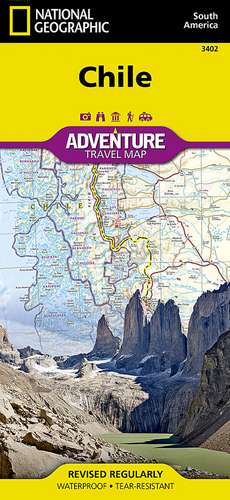
Chile: Travel Maps International Adventure Map
Autor National Geographic Mapsen Limba Engleză Sheet map, folded – 28 ian 2011
- Waterproof - Tear-Resistant - Travel Map
National Geographic's Chile Adventure Map is the perfect travel companion for adventure travelers exploring this long and narrow coastal country occupying much of South America's Pacific coastline. Expertly researched, the map combines unparalleled detail with a user-friendly design, including a handy index of towns, cities and National Parks and Reserves, to help locate them quickly, as well as a clearly marked road network of highways, major and minor roads, and unpaved roads, labeled with distances.
- In addition, hundreds of well-known and off the beaten path cultural, historical and recreational points of interest are highlighted, including UNESCO World Heritage Sites, archeological sites, beaches, lighthouses, monuments, churches, spas and areas for skiing, fishing and surfing.
- Outdoor adventurers will find mapped hiking trails along with such topographic features as contour lines, elevations and labeled peaks.
- The map conveniently covers the country in four sections: from its northern borders with Peru and Bolivia to the city of Copiapo; the next section continues south, through the capital of Santiago, to Concepcion; then into Patagonia and the city of Coihaique, the Chonos Archipelago and Moraleda Channel; finally to the southernmost part of the country with its National Parks and Preserves, including Alberto de Agostini National Park.
- The long border with Argentia is shown with border crossings.
Inset maps cover Easter Island and the Juan Fernandez Islands. This unique map, with its abundance of specialized content. compliments any guidebook.
Every Adventure map is printed on "Travel-Tough" waterproof, tear-resistant paper.
- Map Scale = 1:1,750,000
- Sheet Size = 37.75" x 25.5"
- Folded Size = 4.25" x 9.25"
Preț: 71.27 lei
Disponibil
Livrare economică 28 octombrie-11 noiembrie
Specificații
ISBN-10: 1566955467
Pagini: 1
Ilustrații: , colour illustrations, maps
Dimensiuni: 108 x 235 x 8 mm
Greutate: 0.09 kg
Editura: National Geographic Maps Division
Colecția National Geographic Maps Division
Locul publicării:Washington, United States
